

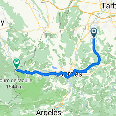
juillan_salamanque_Lisbonne
A cycling route starting in Juillan, Occitanie, France.
Overview
About this route
passing through the Pyrenees
- -:--
- Duration
- 1,204.5 km
- Distance
- 2,179 m
- Ascent
- 2,498 m
- Descent
- ---
- Avg. speed
- ---
- Max. altitude

Route quality
Waytypes & surfaces along the route
Waytypes
Road
409.5 km
(34 %)
Track
228.9 km
(19 %)
Surfaces
Paved
493.8 km
(41 %)
Unpaved
192.7 km
(16 %)
Asphalt
469.8 km
(39 %)
Gravel
84.3 km
(7 %)
Continue with Bikemap
Use, edit, or download this cycling route
You would like to ride juillan_salamanque_Lisbonne or customize it for your own trip? Here is what you can do with this Bikemap route:
Free features
- Save this route as favorite or in collections
- Copy & plan your own version of this route
- Split it into stages to create a multi-day tour
- Sync your route with Garmin or Wahoo
Premium features
Free trial for 3 days, or one-time payment. More about Bikemap Premium.
- Navigate this route on iOS & Android
- Export a GPX / KML file of this route
- Create your custom printout (try it for free)
- Download this route for offline navigation
Discover more Premium features.
Get Bikemap PremiumFrom our community
Other popular routes starting in Juillan
 '1-Camino - Tarbes - Puerto de Somport
- Distance
- 114.3 km
- Ascent
- 2,175 m
- Descent
- 902 m
- Location
- Juillan, Occitanie, France
 Véloroute du Piémont Pyrénéen 02 (Juillan–Montaut)
- Distance
- 30 km
- Ascent
- 654 m
- Descent
- 630 m
- Location
- Juillan, Occitanie, France
 juillan_salamanque_Lisbonne
- Distance
- 1,204.5 km
- Ascent
- 2,179 m
- Descent
- 2,498 m
- Location
- Juillan, Occitanie, France
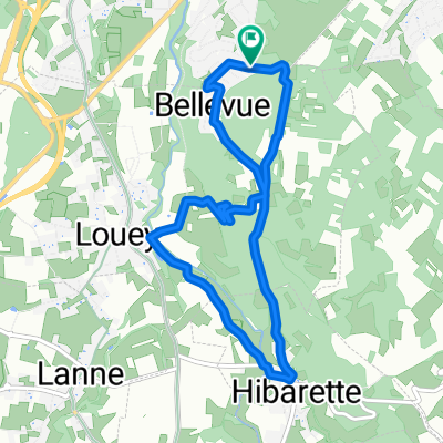 Le tour de Louey
- Distance
- 7.8 km
- Ascent
- 153 m
- Descent
- 153 m
- Location
- Juillan, Occitanie, France
 Louey - Bénac - Julos - Les Granges - Averan - Louey
- Distance
- 29.5 km
- Ascent
- 515 m
- Descent
- 509 m
- Location
- Juillan, Occitanie, France
 route
route- Distance
- 174.7 km
- Ascent
- 465 m
- Descent
- 778 m
- Location
- Juillan, Occitanie, France
 FRspa 2
- Distance
- 70.5 km
- Ascent
- 779 m
- Descent
- 582 m
- Location
- Juillan, Occitanie, France
 5 Chemin de Benaques, Azereix à Chemin de la Passade, Ibos
- Distance
- 4 km
- Ascent
- 73 m
- Descent
- 48 m
- Location
- Juillan, Occitanie, France
Open it in the app