

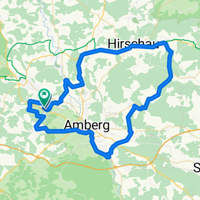
SuRo - Schönlind
A cycling route starting in Poppenricht, Bavaria, Germany.
Overview
About this route
- -:--
- Duration
- 23.9 km
- Distance
- 214 m
- Ascent
- 214 m
- Descent
- ---
- Avg. speed
- ---
- Max. altitude

Route quality
Waytypes & surfaces along the route
Waytypes
Quiet road
14.6 km
(61 %)
Road
5.7 km
(24 %)
Surfaces
Paved
11 km
(46 %)
Unpaved
1.7 km
(7 %)
Asphalt
11 km
(46 %)
Unpaved (undefined)
1 km
(4 %)
Continue with Bikemap
Use, edit, or download this cycling route
You would like to ride SuRo - Schönlind or customize it for your own trip? Here is what you can do with this Bikemap route:
Free features
- Save this route as favorite or in collections
- Copy & plan your own version of this route
- Sync your route with Garmin or Wahoo
Premium features
Free trial for 3 days, or one-time payment. More about Bikemap Premium.
- Navigate this route on iOS & Android
- Export a GPX / KML file of this route
- Create your custom printout (try it for free)
- Download this route for offline navigation
Discover more Premium features.
Get Bikemap PremiumFrom our community
Other popular routes starting in Poppenricht
 Tour 21.08.25
- Distance
- 71.2 km
- Ascent
- 639 m
- Descent
- 629 m
- Location
- Poppenricht, Bavaria, Germany
 Am Fischweg 30, Hahnbach do Richard-Wagner-Straße 3A, Sulzbach-Rosenberg
- Distance
- 24.1 km
- Ascent
- 278 m
- Descent
- 341 m
- Location
- Poppenricht, Bavaria, Germany
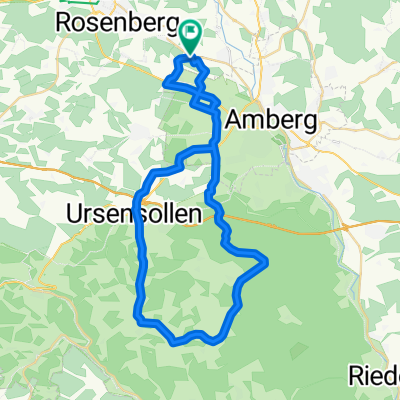
 2011 Amberg Schäflohe-Markt Kastl
- Distance
- 23.3 km
- Ascent
- 338 m
- Descent
- 338 m
- Location
- Poppenricht, Bavaria, Germany
 SuRo - Schönlind
- Distance
- 23.9 km
- Ascent
- 214 m
- Descent
- 214 m
- Location
- Poppenricht, Bavaria, Germany
 Buchberg-Johannisberg-Runde
- Distance
- 49.2 km
- Ascent
- 715 m
- Descent
- 716 m
- Location
- Poppenricht, Bavaria, Germany
 Tour zur Burg Hohenstein
- Distance
- 46.5 km
- Ascent
- 488 m
- Descent
- 324 m
- Location
- Poppenricht, Bavaria, Germany
 Thonhausen Waldhaus
- Distance
- 45.7 km
- Ascent
- 455 m
- Descent
- 455 m
- Location
- Poppenricht, Bavaria, Germany
 2/4 Fünf Flüsse: Amberg - Regensburg
- Distance
- 74.7 km
- Ascent
- 171 m
- Descent
- 208 m
- Location
- Poppenricht, Bavaria, Germany
Open it in the app