

weitere hügelige Rennradrunde
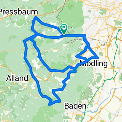
A cycling route starting in Kaltenleutgeben, Lower Austria, Austria.
Overview
About this route
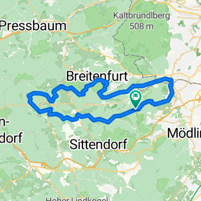
mit dem RC-Mödling bin ich diese Runde ab Maria-Enzersdorf bereits gefahren (Startrichtung Hinterbrühl). Wenn ich von Breitenfurt aus zum Treffpunkt radle, dann kommen diese km noch dazu bzw. fahre ich auf dem Heimweg ab Hinterbrühl rauf zum Tirolerhof und dann über Perchtoldsdorf und Rodaun heim nach Breitenfurt.
- -:--
- Duration
- 96.5 km
- Distance
- 873 m
- Ascent
- 873 m
- Descent
- ---
- Avg. speed
- ---
- Max. altitude
Continue with Bikemap
Use, edit, or download this cycling route
You would like to ride weitere hügelige Rennradrunde or customize it for your own trip? Here is what you can do with this Bikemap route:
Free features
- Save this route as favorite or in collections
- Copy & plan your own version of this route
- Split it into stages to create a multi-day tour
- Sync your route with Garmin or Wahoo
Premium features
Free trial for 3 days, or one-time payment. More about Bikemap Premium.
- Navigate this route on iOS & Android
- Export a GPX / KML file of this route
- Create your custom printout (try it for free)
- Download this route for offline navigation
Discover more Premium features.
Get Bikemap PremiumFrom our community
Other popular routes starting in Kaltenleutgeben
 weitere hügelige Rennradrunde
- Distance
- 96.5 km
- Ascent
- 873 m
- Descent
- 873 m
- Location
- Kaltenleutgeben, Lower Austria, Austria
 Parapluie - EExtdd
- Distance
- 41 km
- Ascent
- 808 m
- Descent
- 808 m
- Location
- Kaltenleutgeben, Lower Austria, Austria
 Schöpflrunde
- Distance
- 98 km
- Ascent
- 1,188 m
- Descent
- 1,073 m
- Location
- Kaltenleutgeben, Lower Austria, Austria
 Steinbruch-See to Atzgersdorf
- Distance
- 7.6 km
- Ascent
- 97 m
- Descent
- 212 m
- Location
- Kaltenleutgeben, Lower Austria, Austria
 Kaltenleutgeben-Lainzer TG
- Distance
- 41 km
- Ascent
- 865 m
- Descent
- 865 m
- Location
- Kaltenleutgeben, Lower Austria, Austria
 Lainzer Tiergartenrunde
- Distance
- 28.4 km
- Ascent
- 736 m
- Descent
- 739 m
- Location
- Kaltenleutgeben, Lower Austria, Austria
 Breitenfurt - Wienerwald - Ba Vöslau - Mödling
- Distance
- 65.6 km
- Ascent
- 993 m
- Descent
- 1,072 m
- Location
- Kaltenleutgeben, Lower Austria, Austria
 Parapluie - Kaltenleutgeben MTB
- Distance
- 32.8 km
- Ascent
- 672 m
- Descent
- 672 m
- Location
- Kaltenleutgeben, Lower Austria, Austria
Open it in the app