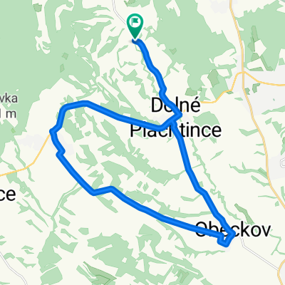
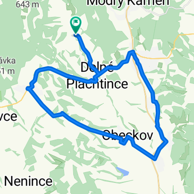
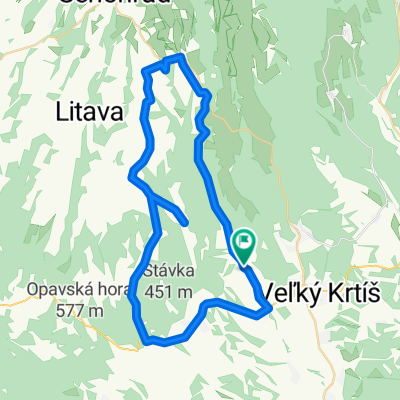
Malý bušinský okruh
A cycling route starting in Veľký Krtíš, Banská Bystrica Region, Slovakia.
Overview
About this route
Loop around Bušiniec and back to Veľký Krtíš
- -:--
- Duration
- 41 km
- Distance
- 452 m
- Ascent
- 452 m
- Descent
- ---
- Avg. speed
- 253 m
- Max. altitude
Route quality
Waytypes & surfaces along the route
Waytypes
Road
35.3 km
(86 %)
Quiet road
5.7 km
(14 %)
Surfaces
Paved
9.4 km
(23 %)
Asphalt
9.4 km
(23 %)
Undefined
31.6 km
(77 %)
Continue with Bikemap
Use, edit, or download this cycling route
You would like to ride Malý bušinský okruh or customize it for your own trip? Here is what you can do with this Bikemap route:
Free features
- Save this route as favorite or in collections
- Copy & plan your own version of this route
- Sync your route with Garmin or Wahoo
Premium features
Free trial for 3 days, or one-time payment. More about Bikemap Premium.
- Navigate this route on iOS & Android
- Export a GPX / KML file of this route
- Create your custom printout (try it for free)
- Download this route for offline navigation
Discover more Premium features.
Get Bikemap PremiumFrom our community
Other popular routes starting in Veľký Krtíš
Stredné Plachtince - Škriavnik - Nová Ves - Malý Krtíš - Veľký Krtíš . Stredné Plachtince- Distance
- 30 km
- Ascent
- 266 m
- Descent
- 267 m
- Location
- Veľký Krtíš, Banská Bystrica Region, Slovakia
Str. Plachtince - Čebovce - Nenince - Ďarmoty - Str. Plachtince- Distance
- 43.4 km
- Ascent
- 289 m
- Descent
- 291 m
- Location
- Veľký Krtíš, Banská Bystrica Region, Slovakia
BB-Dolná Strehová 3- Distance
- 90.1 km
- Ascent
- 334 m
- Descent
- 338 m
- Location
- Veľký Krtíš, Banská Bystrica Region, Slovakia
BB-Dolná Strehová 4- Distance
- 97 km
- Ascent
- 862 m
- Descent
- 617 m
- Location
- Veľký Krtíš, Banská Bystrica Region, Slovakia
Stredné Plachtince - lesom Trúbiaci kameň a Sucháň - pod Vysielač a cez Čebovce späť- Distance
- 41.1 km
- Ascent
- 754 m
- Descent
- 757 m
- Location
- Veľký Krtíš, Banská Bystrica Region, Slovakia
BB-Dolná Strehová 2- Distance
- 68.3 km
- Ascent
- 720 m
- Descent
- 734 m
- Location
- Veľký Krtíš, Banská Bystrica Region, Slovakia
Str. Plachtince - Kosihovce - Trebušovce - Lesenice - Ďarmoty - Str. Plachtince- Distance
- 49.4 km
- Ascent
- 307 m
- Descent
- 309 m
- Location
- Veľký Krtíš, Banská Bystrica Region, Slovakia
Str. Plachtince - Čebovce - Španí laz - Str. Plachtince- Distance
- 47.6 km
- Ascent
- 824 m
- Descent
- 826 m
- Location
- Veľký Krtíš, Banská Bystrica Region, Slovakia
Open it in the app


