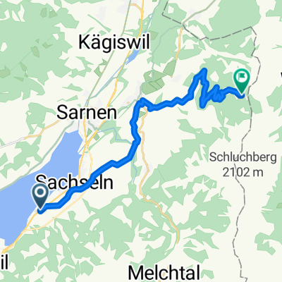
los Glaunberg
A cycling route starting in Sachseln, Canton of Obwalden, Switzerland.
Overview
About this route
- -:--
- Duration
- 82.7 km
- Distance
- 1,985 m
- Ascent
- 1,986 m
- Descent
- ---
- Avg. speed
- ---
- Avg. speed
Route quality
Waytypes & surfaces along the route
Waytypes
Road
37.6 km
(45 %)
Busy road
24.6 km
(30 %)
Surfaces
Paved
29.2 km
(35 %)
Unpaved
5.8 km
(7 %)
Asphalt
27.8 km
(34 %)
Unpaved (undefined)
4.3 km
(5 %)
Continue with Bikemap
Use, edit, or download this cycling route
You would like to ride los Glaunberg or customize it for your own trip? Here is what you can do with this Bikemap route:
Free features
- Save this route as favorite or in collections
- Copy & plan your own version of this route
- Sync your route with Garmin or Wahoo
Premium features
Free trial for 3 days, or one-time payment. More about Bikemap Premium.
- Navigate this route on iOS & Android
- Export a GPX / KML file of this route
- Create your custom printout (try it for free)
- Download this route for offline navigation
Discover more Premium features.
Get Bikemap PremiumFrom our community
Other popular routes starting in Sachseln
- Melchsee-Frutt
- Distance
- 62.7 km
- Ascent
- 1,921 m
- Descent
- 1,924 m
- Location
- Sachseln, Canton of Obwalden, Switzerland
- Seerunfahrt mit Steigung
- Distance
- 24.8 km
- Ascent
- 1,383 m
- Descent
- 1,397 m
- Location
- Sachseln, Canton of Obwalden, Switzerland
- Älggi Tour OW
- Distance
- 31.3 km
- Ascent
- 1,240 m
- Descent
- 1,242 m
- Location
- Sachseln, Canton of Obwalden, Switzerland
- CH19_Rund um den Sarner See (gU)
- Distance
- 17.3 km
- Ascent
- 133 m
- Descent
- 133 m
- Location
- Sachseln, Canton of Obwalden, Switzerland
- V2_E04_ALPX_Schweiz
- Distance
- 45.5 km
- Ascent
- 2,673 m
- Descent
- 1,203 m
- Location
- Sachseln, Canton of Obwalden, Switzerland
- Melchsee-Planplatten-Tour
- Distance
- 62 km
- Ascent
- 2,057 m
- Descent
- 2,058 m
- Location
- Sachseln, Canton of Obwalden, Switzerland
- Sachseln - Glaubenberg - Entlebuch - Sörenberg - Glaubenbielen - Sachseln
- Distance
- 85.9 km
- Ascent
- 2,035 m
- Descent
- 2,032 m
- Location
- Sachseln, Canton of Obwalden, Switzerland
- 14-C07-Sempach
- Distance
- 48.3 km
- Ascent
- 323 m
- Descent
- 298 m
- Location
- Sachseln, Canton of Obwalden, Switzerland
Open it in the app