

Paris Ste Marg' 2
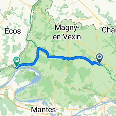
A cycling route starting in Vigny, Île-de-France Region, France.
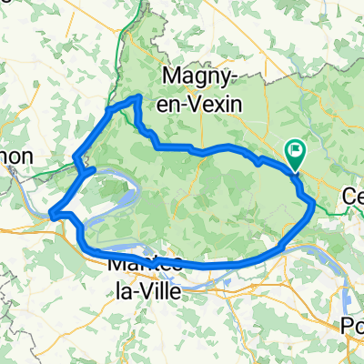
Overview
About this route
Deuxième tronçon
- -:--
- Duration
- 126.5 km
- Distance
- 695 m
- Ascent
- 671 m
- Descent
- ---
- Avg. speed
- ---
- Max. altitude

Route quality
Waytypes & surfaces along the route
Waytypes
Road
36.7 km
(29 %)
Quiet road
20.2 km
(16 %)
Surfaces
Paved
55.6 km
(44 %)
Asphalt
54.4 km
(43 %)
Paved (undefined)
1.3 km
(1 %)
Undefined
70.8 km
(56 %)
Continue with Bikemap
Use, edit, or download this cycling route
You would like to ride Paris Ste Marg' 2 or customize it for your own trip? Here is what you can do with this Bikemap route:
Free features
- Save this route as favorite or in collections
- Copy & plan your own version of this route
- Split it into stages to create a multi-day tour
- Sync your route with Garmin or Wahoo
Premium features
Free trial for 3 days, or one-time payment. More about Bikemap Premium.
- Navigate this route on iOS & Android
- Export a GPX / KML file of this route
- Create your custom printout (try it for free)
- Download this route for offline navigation
Discover more Premium features.
Get Bikemap PremiumFrom our community
Other popular routes starting in Vigny
 Paris-Tours-jac32-end1
- Distance
- 253 km
- Ascent
- 1,636 m
- Descent
- 1,662 m
- Location
- Vigny, Île-de-France Region, France
 Étape 2: Place Saint - Lô 2bis, Théméricourt to Chemin de Rouville 1, Amécourt
- Distance
- 55 km
- Ascent
- 421 m
- Descent
- 351 m
- Location
- Vigny, Île-de-France Region, France
 Place du Président Chevalier, Théméricourt à La Roche-Guyon
- Distance
- 27.4 km
- Ascent
- 299 m
- Descent
- 284 m
- Location
- Vigny, Île-de-France Region, France
 De 2 Grande Rue, Gouzangrez à Rue du Bois des Fosses, Dreux
- Distance
- 72 km
- Ascent
- 456 m
- Descent
- 466 m
- Location
- Vigny, Île-de-France Region, France
 Vigny 84
- Distance
- 83.8 km
- Ascent
- 392 m
- Descent
- 392 m
- Location
- Vigny, Île-de-France Region, France
 Day 4
Day 4- Distance
- 77.6 km
- Ascent
- 391 m
- Descent
- 423 m
- Location
- Vigny, Île-de-France Region, France
 De Rue des Bruyères 12, Avernes à Rue du Pressoir 6, Vernouillet
- Distance
- 40.8 km
- Ascent
- 233 m
- Descent
- 322 m
- Location
- Vigny, Île-de-France Region, France
 Vexin par villarceaux
- Distance
- 59.5 km
- Ascent
- 553 m
- Descent
- 555 m
- Location
- Vigny, Île-de-France Region, France
Open it in the app