

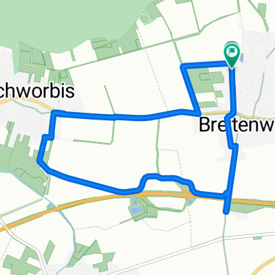
Eichsfelder Becken- und Dünradrunde für MTB
A cycling route starting in Breitenworbis, Thuringia, Germany.
Overview
About this route
Note: The section from Kleinbartloff to Hüpstedt initially climbs serpentinely up the Dün. This isn't very clear in the description here, but you can hardly miss it, as there's ultimately only one path that leads up ;-). It's important that once you arrive at the top, you don't take the upper Dün hiking path, which is unsuitable for most bikes, but continue straight onto the next forestry path. There, you'll then turn right at the next opportunity to reach Hüpstedt-Birkunger Street.
For the rest of the route, you can't go wrong.
- -:--
- Duration
- 47.2 km
- Distance
- 537 m
- Ascent
- 557 m
- Descent
- ---
- Avg. speed
- 512 m
- Max. altitude
Route quality
Waytypes & surfaces along the route
Waytypes
Track
16.1 km
(34 %)
Road
10.4 km
(22 %)
Surfaces
Paved
28.3 km
(60 %)
Unpaved
10.9 km
(23 %)
Asphalt
26.9 km
(57 %)
Gravel
4.7 km
(10 %)
Continue with Bikemap
Use, edit, or download this cycling route
You would like to ride Eichsfelder Becken- und Dünradrunde für MTB or customize it for your own trip? Here is what you can do with this Bikemap route:
Free features
- Save this route as favorite or in collections
- Copy & plan your own version of this route
- Sync your route with Garmin or Wahoo
Premium features
Free trial for 3 days, or one-time payment. More about Bikemap Premium.
- Navigate this route on iOS & Android
- Export a GPX / KML file of this route
- Create your custom printout (try it for free)
- Download this route for offline navigation
Discover more Premium features.
Get Bikemap PremiumFrom our community
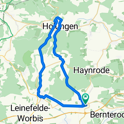
Other popular routes starting in Breitenworbis
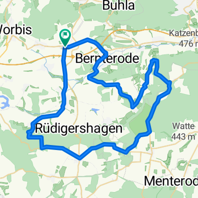 Eichsfelder Becken- und Dünradrunde für MTB
- Distance
- 47.2 km
- Ascent
- 537 m
- Descent
- 557 m
- Location
- Breitenworbis, Thuringia, Germany
 Mühlhäuser Straße 6, Breitenworbis nach Mühlhäuser Straße 6, Breitenworbis
- Distance
- 14.5 km
- Ascent
- 233 m
- Descent
- 234 m
- Location
- Breitenworbis, Thuringia, Germany
 Mühlhäuser Straße 4, Breitenworbis nach Mühlhäuser Straße 8, Breitenworbis
- Distance
- 39.4 km
- Ascent
- 624 m
- Descent
- 621 m
- Location
- Breitenworbis, Thuringia, Germany
 Mühlhäuser Straße 1, Breitenworbis nach Mühlhäuser Straße 8, Breitenworbis
- Distance
- 40.1 km
- Ascent
- 496 m
- Descent
- 497 m
- Location
- Breitenworbis, Thuringia, Germany
 Mühlhäuser Straße 6, Breitenworbis nach Mühlhäuser Straße 6, Breitenworbis
- Distance
- 21 km
- Ascent
- 204 m
- Descent
- 204 m
- Location
- Breitenworbis, Thuringia, Germany
 birkungen.
- Distance
- 12 km
- Ascent
- 92 m
- Descent
- 52 m
- Location
- Breitenworbis, Thuringia, Germany
 Breitenworbis-Sonnenstein-Worbis
- Distance
- 29.9 km
- Ascent
- 487 m
- Descent
- 487 m
- Location
- Breitenworbis, Thuringia, Germany
 Karrenweg
- Distance
- 6.8 km
- Ascent
- 47 m
- Descent
- 45 m
- Location
- Breitenworbis, Thuringia, Germany
Open it in the app