
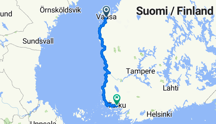
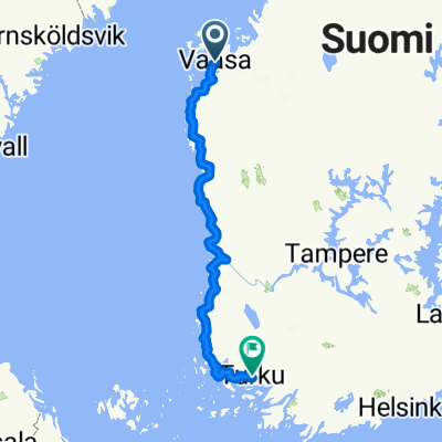
Vasa-Turku
A cycling route starting in Vaasa, Ostrobothnia, Finland.
Overview
About this route
- -:--
- Duration
- 467.2 km
- Distance
- 135 m
- Ascent
- 123 m
- Descent
- ---
- Avg. speed
- ---
- Max. altitude
Route quality
Waytypes & surfaces along the route
Waytypes
Road
205.6 km
(44 %)
Cycleway
116.8 km
(25 %)
Surfaces
Paved
317.7 km
(68 %)
Unpaved
18.7 km
(4 %)
Asphalt
271 km
(58 %)
Paved (undefined)
46.7 km
(10 %)
Continue with Bikemap
Use, edit, or download this cycling route
You would like to ride Vasa-Turku or customize it for your own trip? Here is what you can do with this Bikemap route:
Free features
- Save this route as favorite or in collections
- Copy & plan your own version of this route
- Split it into stages to create a multi-day tour
- Sync your route with Garmin or Wahoo
Premium features
Free trial for 3 days, or one-time payment. More about Bikemap Premium.
- Navigate this route on iOS & Android
- Export a GPX / KML file of this route
- Create your custom printout (try it for free)
- Download this route for offline navigation
Discover more Premium features.
Get Bikemap PremiumFrom our community
Other popular routes starting in Vaasa
 Svezia 2014 c) => Giro del Baltico 2)
- Distance
- 476.8 km
- Ascent
- 178 m
- Descent
- 168 m
- Location
- Vaasa, Ostrobothnia, Finland
 Meijerinkatu 8, Vaasa naar Rådhusgatan 2, Pietarsaari
- Distance
- 134.1 km
- Ascent
- 426 m
- Descent
- 423 m
- Location
- Vaasa, Ostrobothnia, Finland
 nationell cykel vasa
- Distance
- 98.9 km
- Ascent
- 83 m
- Descent
- 82 m
- Location
- Vaasa, Ostrobothnia, Finland
 Day 9: Vaasa - Fädobu (105km)
- Distance
- 104.6 km
- Ascent
- 80 m
- Descent
- 86 m
- Location
- Vaasa, Ostrobothnia, Finland
 Vasa-Turku
- Distance
- 467.2 km
- Ascent
- 135 m
- Descent
- 123 m
- Location
- Vaasa, Ostrobothnia, Finland
 Institutgatan 51, Vasa to Institutgatan 51, Vasa
- Distance
- 14.3 km
- Ascent
- 57 m
- Descent
- 57 m
- Location
- Vaasa, Ostrobothnia, Finland
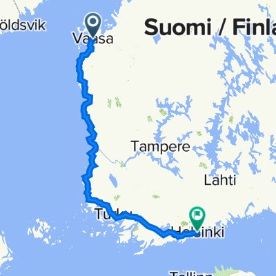
 От Raastuvankatu 26, Vaasa до Hertig Johans parkgata 8, Åbo
- Distance
- 592.7 km
- Ascent
- 1,634 m
- Descent
- 1,633 m
- Location
- Vaasa, Ostrobothnia, Finland
 Handelsesplanaden 13, Vasa to Mannerheimvägen 22, Helsingfors
- Distance
- 607 km
- Ascent
- 3,054 m
- Descent
- 3,034 m
- Location
- Vaasa, Ostrobothnia, Finland
Open it in the app