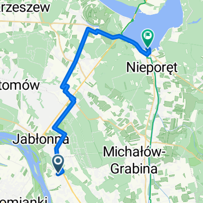
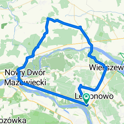
Trening
A cycling route starting in Jabłonna, Masovian Voivodeship, Poland.
Overview
About this route
- -:--
- Duration
- 67.5 km
- Distance
- 100 m
- Ascent
- 105 m
- Descent
- ---
- Avg. speed
- ---
- Max. altitude
Route quality
Waytypes & surfaces along the route
Waytypes
Road
21.6 km
(32 %)
Cycleway
16.9 km
(25 %)
Surfaces
Paved
44.6 km
(66 %)
Unpaved
3.4 km
(5 %)
Asphalt
42.5 km
(63 %)
Paved (undefined)
2 km
(3 %)
Continue with Bikemap
Use, edit, or download this cycling route
You would like to ride Trening or customize it for your own trip? Here is what you can do with this Bikemap route:
Free features
- Save this route as favorite or in collections
- Copy & plan your own version of this route
- Sync your route with Garmin or Wahoo
Premium features
Free trial for 3 days, or one-time payment. More about Bikemap Premium.
- Navigate this route on iOS & Android
- Export a GPX / KML file of this route
- Create your custom printout (try it for free)
- Download this route for offline navigation
Discover more Premium features.
Get Bikemap PremiumFrom our community
Other popular routes starting in Jabłonna
- Kibiców, Warszawa do Światowida, Białołęka
- Distance
- 20.2 km
- Ascent
- 528 m
- Descent
- 525 m
- Location
- Jabłonna, Masovian Voivodeship, Poland
- Dom - Praca
- Distance
- 13.5 km
- Ascent
- 38 m
- Descent
- 19 m
- Location
- Jabłonna, Masovian Voivodeship, Poland
- Warszawa-Toruń dzień 1
- Distance
- 120.3 km
- Ascent
- 170 m
- Descent
- 191 m
- Location
- Jabłonna, Masovian Voivodeship, Poland
- 2013 Pomiechówek może tak
- Distance
- 66.1 km
- Ascent
- 150 m
- Descent
- 150 m
- Location
- Jabłonna, Masovian Voivodeship, Poland
- Trening
- Distance
- 67.5 km
- Ascent
- 100 m
- Descent
- 105 m
- Location
- Jabłonna, Masovian Voivodeship, Poland
- I znowu w las 😁, Legionowo
- Distance
- 7.7 km
- Ascent
- 51 m
- Descent
- 53 m
- Location
- Jabłonna, Masovian Voivodeship, Poland
- tdw 200 moja
- Distance
- 208.1 km
- Ascent
- 207 m
- Descent
- 200 m
- Location
- Jabłonna, Masovian Voivodeship, Poland
- Jabłona_działka
- Distance
- 13.2 km
- Ascent
- 20 m
- Descent
- 22 m
- Location
- Jabłonna, Masovian Voivodeship, Poland
Open it in the app