

Snail-like route in Warrington
A cycling route starting in Warrington, England, United Kingdom.
Overview
About this route
- 15 min
- Duration
- 2.8 km
- Distance
- 19 m
- Ascent
- 4 m
- Descent
- 10.9 km/h
- Avg. speed
- ---
- Max. altitude

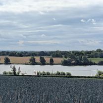
Route photos


Route quality
Waytypes & surfaces along the route
Waytypes
Cycleway
1.1 km
(39 %)
Road
0.9 km
(32 %)
Surfaces
Paved
2.1 km
(75 %)
Asphalt
2.1 km
(75 %)
Undefined
0.7 km
(25 %)
Continue with Bikemap
Use, edit, or download this cycling route
You would like to ride Snail-like route in Warrington or customize it for your own trip? Here is what you can do with this Bikemap route:
Free features
- Save this route as favorite or in collections
- Copy & plan your own version of this route
- Sync your route with Garmin or Wahoo
Premium features
Free trial for 3 days, or one-time payment. More about Bikemap Premium.
- Navigate this route on iOS & Android
- Export a GPX / KML file of this route
- Create your custom printout (try it for free)
- Download this route for offline navigation
Discover more Premium features.
Get Bikemap PremiumFrom our community
Other popular routes starting in Warrington
 cruisein down 160 route in Warrington
- Distance
- 4.3 km
- Ascent
- 0 m
- Descent
- 4 m
- Location
- Warrington, England, United Kingdom
 Chester Road 1A to Longshaw Street 182
- Distance
- 4.8 km
- Ascent
- 20 m
- Descent
- 18 m
- Location
- Warrington, England, United Kingdom
 618 Hawley's Lane, Warrington to 501 Westbrook Centre, Warrington
- Distance
- 2.7 km
- Ascent
- 10 m
- Descent
- 7 m
- Location
- Warrington, England, United Kingdom
 widnes
- Distance
- 28.5 km
- Ascent
- 78 m
- Descent
- 52 m
- Location
- Warrington, England, United Kingdom
 nipped out
- Distance
- 1.7 km
- Ascent
- 27 m
- Descent
- 19 m
- Location
- Warrington, England, United Kingdom
 Winwick Road to East Lancashire Road, Leigh
- Distance
- 24.8 km
- Ascent
- 110 m
- Descent
- 93 m
- Location
- Warrington, England, United Kingdom
 Relaxed route in Newton-le-Willows
- Distance
- 9.4 km
- Ascent
- 258 m
- Descent
- 243 m
- Location
- Warrington, England, United Kingdom
 Poplars Avenue to Poplars Avenue
- Distance
- 67.5 km
- Ascent
- 295 m
- Descent
- 347 m
- Location
- Warrington, England, United Kingdom
Open it in the app