

Una más!!!💪💪🤙🤙
A cycling route starting in Elche, Valencia, Spain.
Overview
About this route
- 3 h 17 min
- Duration
- 38.9 km
- Distance
- 307 m
- Ascent
- 296 m
- Descent
- 11.8 km/h
- Avg. speed
- ---
- Max. altitude

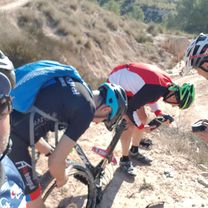
Route photos


Continue with Bikemap
Use, edit, or download this cycling route
You would like to ride Una más!!!💪💪🤙🤙 or customize it for your own trip? Here is what you can do with this Bikemap route:
Free features
- Save this route as favorite or in collections
- Copy & plan your own version of this route
- Sync your route with Garmin or Wahoo
Premium features
Free trial for 3 days, or one-time payment. More about Bikemap Premium.
- Navigate this route on iOS & Android
- Export a GPX / KML file of this route
- Create your custom printout (try it for free)
- Download this route for offline navigation
Discover more Premium features.
Get Bikemap PremiumFrom our community
Other popular routes starting in Elche
 27 - 12 - 2014 ELCHE - LOS ARENALES - SANTA POLA - VEREDA - ELCHER
- Distance
- 55.7 km
- Ascent
- 154 m
- Descent
- 162 m
- Location
- Elche, Valencia, Spain
 Altabix al Pantano
- Distance
- 18.6 km
- Ascent
- 190 m
- Descent
- 190 m
- Location
- Elche, Valencia, Spain
 23 - 11 - 2014 PACO, JOSE , PAQUITO Y YO
- Distance
- 43.8 km
- Ascent
- 483 m
- Descent
- 481 m
- Location
- Elche, Valencia, Spain
 Una más!!!💪💪🤙🤙
- Distance
- 38.9 km
- Ascent
- 307 m
- Descent
- 296 m
- Location
- Elche, Valencia, Spain
 subida al pijo y la gallinica
- Distance
- 38.8 km
- Ascent
- 344 m
- Descent
- 354 m
- Location
- Elche, Valencia, Spain
 Barranco del grifo
- Distance
- 26.4 km
- Ascent
- 249 m
- Descent
- 262 m
- Location
- Elche, Valencia, Spain
 Torrellano-Santa Pola-Urbanova-Torrellano
- Distance
- 59.6 km
- Ascent
- 255 m
- Descent
- 253 m
- Location
- Elche, Valencia, Spain
 Empezamos 🤙🤙💪💪
- Distance
- 36.8 km
- Ascent
- 343 m
- Descent
- 340 m
- Location
- Elche, Valencia, Spain
Open it in the app