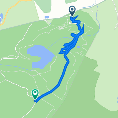
UK - COED LLANDEGLA FOREST (niebieska)
A cycling route starting in Llandegla, Wales, United Kingdom.
Overview
About this route
The route is located in the Coed Llandegla forest in North Wales. The trails, varying in difficulty levels, stretch over 650 hectares of forest planted in 1972/73. As an interesting fact – within a one-mile radius from the forest center there is 50% of the Welsh capercaillie population. On the trail you can also stop at an observation point for these birds.
There are 4 trails to choose from with different difficulty levels. Green (5 km) - Family trail, Blue (12 km) - Beginner trail, Red (18 km) for Intermediate riders, and Black (21 km) for Professionals. We chose the Blue trail. The whole fun starts with renting a bike (for a fee). If you own your bike, you only pay for parking... unless you arrived by bike, then the whole event costs you nothing. Helmet is mandatory.
The route begins with steep climbs in the forest with sharp turns. Later we reach an open space, in other words, a clear-cut forest. Here at the second kilometer of the route begins a light but long, nearly three-kilometer climb. At its beginning, you can stop at the aforementioned capercaillie observatory. The real fun starts at the fifth kilometer. 550 meters above sea level and the highest point of all trails. We enter dense forest again, but now only downhill, steep downhill! Switchbacks, jumps, ruts and what we like the most, and what our shocks, wheels and especially hands dislike – lots of rocks and bumps. From here it doesn't take us much time to cover the next 5 km of the trail. Just a short break at the 7th kilometer and admiring beautiful panoramas and views of the nearby Welsh hills (Shotton View viewpoint). Then, by gentler descents, we reach a small lake, where it is also worth stopping and washing the muddy face with icy water. Ahead of us is just the BMX park-trail where some braver riders can try their skills jumping over the mounds. From there the last descent, quite spectacular ending with a wide side rut and we arrive at the building where we rented the bike. In the building itself there is a restaurant, an information point, and a bike shop with a workshop.
Next time the Red trail.
www.coedllandegla.com www.coedllandegla.com/Photo_Gallery www.oneplanetadventure.com
- -:--
- Duration
- 11.5 km
- Distance
- 196 m
- Ascent
- 187 m
- Descent
- ---
- Avg. speed
- ---
- Max. altitude
Route quality
Waytypes & surfaces along the route
Waytypes
Cycleway
9.3 km
(81 %)
Path
1.3 km
(11 %)
Surfaces
Unpaved
10.6 km
(92 %)
Unpaved (undefined)
10.4 km
(91 %)
Gravel
0.1 km
(1 %)
Undefined
0.9 km
(8 %)
Route highlights
Points of interest along the route

Point of interest after 6.9 km

Point of interest after 11.5 km
Continue with Bikemap
Use, edit, or download this cycling route
You would like to ride UK - COED LLANDEGLA FOREST (niebieska) or customize it for your own trip? Here is what you can do with this Bikemap route:
Free features
- Save this route as favorite or in collections
- Copy & plan your own version of this route
- Sync your route with Garmin or Wahoo
Premium features
Free trial for 3 days, or one-time payment. More about Bikemap Premium.
- Navigate this route on iOS & Android
- Export a GPX / KML file of this route
- Create your custom printout (try it for free)
- Download this route for offline navigation
Discover more Premium features.
Get Bikemap PremiumFrom our community
Other popular routes starting in Llandegla
 Steady ride
- Distance
- 3 km
- Ascent
- 93 m
- Descent
- 27 m
- Location
- Llandegla, Wales, United Kingdom
 Bike Centre to Somewhere Else
- Distance
- 16.6 km
- Ascent
- 420 m
- Descent
- 499 m
- Location
- Llandegla, Wales, United Kingdom
 UK - COED LLANDEGLA FOREST (czerwona)
- Distance
- 17.3 km
- Ascent
- 361 m
- Descent
- 352 m
- Location
- Llandegla, Wales, United Kingdom
 Coed LLandegla Black
- Distance
- 19.8 km
- Ascent
- 372 m
- Descent
- 380 m
- Location
- Llandegla, Wales, United Kingdom
 Llandegla - Black Route
- Distance
- 19.1 km
- Ascent
- 363 m
- Descent
- 363 m
- Location
- Llandegla, Wales, United Kingdom
 UK - COED LLANDEGLA FOREST (niebieska)
- Distance
- 11.5 km
- Ascent
- 196 m
- Descent
- 187 m
- Location
- Llandegla, Wales, United Kingdom
 llandegla red and black Recording from 12 September 10:06 AM
- Distance
- 20.7 km
- Ascent
- 339 m
- Descent
- 339 m
- Location
- Llandegla, Wales, United Kingdom
 The Retreat, Horseshoe Pass, Llangollen to Damson Cottage, Barton Road, Malpas
- Distance
- 34.2 km
- Ascent
- 225 m
- Descent
- 601 m
- Location
- Llandegla, Wales, United Kingdom
Open it in the app


