

Hoherodskopfrunde
A cycling route starting in Herbstein, Hesse, Germany.
Overview
About this route
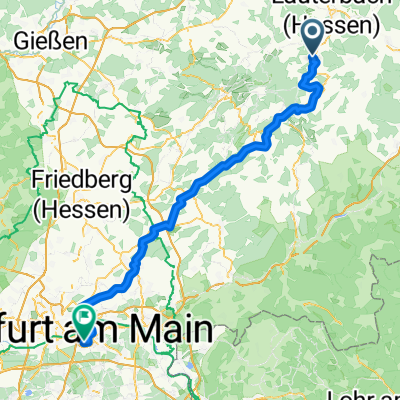
Beautiful ride around and on the Hoherodskopf of about 45 km. Starting at the Kolping Holiday Village in Herbstein, then on the bike path to about 3 km past Engelrod, from there into the forest towards Moor / Hoherodskopf (partly singletrail through forest and meadow). From there at the top, a nice descent through the forest to Grebenhain-Oberwald, then back to Herbstein on the Volcano Bike Trail.
- -:--
- Duration
- 45.1 km
- Distance
- 423 m
- Ascent
- 423 m
- Descent
- ---
- Avg. speed
- ---
- Max. altitude

Route quality
Waytypes & surfaces along the route
Waytypes
Track
17.6 km
(39 %)
Cycleway
11.7 km
(26 %)
Surfaces
Paved
24.8 km
(55 %)
Unpaved
14.9 km
(33 %)
Asphalt
23 km
(51 %)
Gravel
8.1 km
(18 %)
Continue with Bikemap
Use, edit, or download this cycling route
You would like to ride Hoherodskopfrunde or customize it for your own trip? Here is what you can do with this Bikemap route:
Free features
- Save this route as favorite or in collections
- Copy & plan your own version of this route
- Sync your route with Garmin or Wahoo
Premium features
Free trial for 3 days, or one-time payment. More about Bikemap Premium.
- Navigate this route on iOS & Android
- Export a GPX / KML file of this route
- Create your custom printout (try it for free)
- Download this route for offline navigation
Discover more Premium features.
Get Bikemap PremiumFrom our community
Other popular routes starting in Herbstein
 Trailtour von Herbstein
- Distance
- 57.5 km
- Ascent
- 1,241 m
- Descent
- 1,242 m
- Location
- Herbstein, Hesse, Germany
 Lauterbach / Hessen - Offenbach am Main
- Distance
- 93.5 km
- Ascent
- 607 m
- Descent
- 913 m
- Location
- Herbstein, Hesse, Germany
 Bahnradweg_Tag_4
- Distance
- 110.9 km
- Ascent
- 736 m
- Descent
- 1,013 m
- Location
- Herbstein, Hesse, Germany
 Kleine Runde über Lanzenhain
- Distance
- 19.8 km
- Ascent
- 333 m
- Descent
- 333 m
- Location
- Herbstein, Hesse, Germany
 Rixfelder
- Distance
- 57.1 km
- Ascent
- 373 m
- Descent
- 371 m
- Location
- Herbstein, Hesse, Germany
 Jlbeshäuser Weg 7, Herbstein nach Freiensteinau
- Distance
- 13.5 km
- Ascent
- 200 m
- Descent
- 162 m
- Location
- Herbstein, Hesse, Germany
 Hoherodskopfrunde
- Distance
- 45.1 km
- Ascent
- 423 m
- Descent
- 423 m
- Location
- Herbstein, Hesse, Germany
 Herbstein - Ober-Seemen,Vulkanradweg
- Distance
- 27.9 km
- Ascent
- 249 m
- Descent
- 239 m
- Location
- Herbstein, Hesse, Germany
Open it in the app