

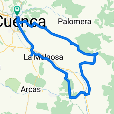
Ruta Cuenca - Sotos - Ribatajada - Arcos - Villalba - Cuenca (campichuelo clásico)
A cycling route starting in Cuenca, Castille-La Mancha, Spain.
Overview
About this route
Ruta de 76 km con almuerzo en Villalba
- -:--
- Duration
- 76.7 km
- Distance
- 340 m
- Ascent
- 343 m
- Descent
- ---
- Avg. speed
- ---
- Max. altitude

Route quality
Waytypes & surfaces along the route
Waytypes
Road
45.3 km
(59 %)
Path
6.9 km
(9 %)
Surfaces
Paved
29.2 km
(38 %)
Asphalt
29.2 km
(38 %)
Undefined
47.6 km
(62 %)
Continue with Bikemap
Use, edit, or download this cycling route
You would like to ride Ruta Cuenca - Sotos - Ribatajada - Arcos - Villalba - Cuenca (campichuelo clásico) or customize it for your own trip? Here is what you can do with this Bikemap route:
Free features
- Save this route as favorite or in collections
- Copy & plan your own version of this route
- Sync your route with Garmin or Wahoo
Premium features
Free trial for 3 days, or one-time payment. More about Bikemap Premium.
- Navigate this route on iOS & Android
- Export a GPX / KML file of this route
- Create your custom printout (try it for free)
- Download this route for offline navigation
Discover more Premium features.
Get Bikemap PremiumFrom our community
Other popular routes starting in Cuenca
 Dolmen en Colliga, Cuenca
- Distance
- 50.6 km
- Ascent
- 570 m
- Descent
- 560 m
- Location
- Cuenca, Castille-La Mancha, Spain
 Casasola, Chantre, Cerro de San Cristobal
- Distance
- 40.7 km
- Ascent
- 476 m
- Descent
- 473 m
- Location
- Cuenca, Castille-La Mancha, Spain
 Lagunas de Fuentes
- Distance
- 40.5 km
- Ascent
- 318 m
- Descent
- 318 m
- Location
- Cuenca, Castille-La Mancha, Spain
 Alto de la Nava
- Distance
- 46.3 km
- Ascent
- 625 m
- Descent
- 624 m
- Location
- Cuenca, Castille-La Mancha, Spain
 Las Zomas. La Mota
- Distance
- 42.6 km
- Ascent
- 517 m
- Descent
- 516 m
- Location
- Cuenca, Castille-La Mancha, Spain
 El Terminillo
- Distance
- 12.8 km
- Ascent
- 37 m
- Descent
- 38 m
- Location
- Cuenca, Castille-La Mancha, Spain
 Cuenca-ciudad encantada-
- Distance
- 63.7 km
- Ascent
- 995 m
- Descent
- 989 m
- Location
- Cuenca, Castille-La Mancha, Spain
 Vallejo de la Cueva del Fraile
- Distance
- 41.9 km
- Ascent
- 446 m
- Descent
- 449 m
- Location
- Cuenca, Castille-La Mancha, Spain
Open it in the app