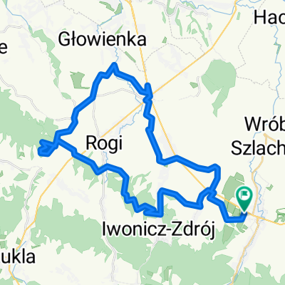
zr贸d艂a jasio艂ki, polany surowiczne, przymiarki
A cycling route starting in Ryman贸w, Subcarpathian Voivodeship, Poland.
Overview
About this route
- -:--
- Duration
- 83.5 km
- Distance
- 1,459 m
- Ascent
- 1,450 m
- Descent
- ---
- Avg. speed
- ---
- Avg. speed
Route quality
Waytypes & surfaces along the route
Waytypes
Track
35.6 km
(43 %)
Quiet road
19.9 km
(24 %)
Surfaces
Paved
43.2 km
(52 %)
Unpaved
28.9 km
(35 %)
Asphalt
38.5 km
(46 %)
Ground
12.2 km
(15 %)
Continue with Bikemap
Use, edit, or download this cycling route
You would like to ride zr贸d艂a jasio艂ki, polany surowiczne, przymiarki or customize it for your own trip? Here is what you can do with this Bikemap route:
Free features
- Save this route as favorite or in collections
- Copy & plan your own version of this route
- Sync your route with Garmin or Wahoo
Premium features
Free trial for 3 days, or one-time payment. More about Bikemap Premium.
- Navigate this route on iOS & Android
- Export a GPX / KML file of this route
- Create your custom printout (try it for free)
- Download this route for offline navigation
Discover more Premium features.
Get Bikemap PremiumFrom our community
Other popular routes starting in Ryman贸w
- Beskid Niski 艁emkowszczyzna
- Distance
- 110.5 km
- Ascent
- 0 m
- Descent
- 0 m
- Location
- Ryman贸w, Subcarpathian Voivodeship, Poland
- 20220902
- Distance
- 88 km
- Ascent
- 833 m
- Descent
- 833 m
- Location
- Ryman贸w, Subcarpathian Voivodeship, Poland
- Ryman贸w - podkarpackie on an bicycle
- Distance
- 32.6 km
- Ascent
- 436 m
- Descent
- 437 m
- Location
- Ryman贸w, Subcarpathian Voivodeship, Poland
- Ryman贸w-kalwaria-mogi艂a-sucha g贸ra-klimk贸wka-艂ysa g贸ra-pustki-ryman贸w
- Distance
- 18.5 km
- Ascent
- 583 m
- Descent
- 581 m
- Location
- Ryman贸w, Subcarpathian Voivodeship, Poland
- Ryman贸w - Trze艣mi贸w - D艂ugie
- Distance
- 25.3 km
- Ascent
- 101 m
- Descent
- 134 m
- Location
- Ryman贸w, Subcarpathian Voivodeship, Poland
- Ryman贸w - Miejsce Piastowe - Dukla - Daliowa (p臋tla)
- Distance
- 54.6 km
- Ascent
- 465 m
- Descent
- 465 m
- Location
- Ryman贸w, Subcarpathian Voivodeship, Poland
- Zdrojowa 57, Ryman贸w-Zdr贸j do Zdrojowa 57, Ryman贸w-Zdr贸j
- Distance
- 51 km
- Ascent
- 774 m
- Descent
- 774 m
- Location
- Ryman贸w, Subcarpathian Voivodeship, Poland
- 3/2018
- Distance
- 46.9 km
- Ascent
- 840 m
- Descent
- 862 m
- Location
- Ryman贸w, Subcarpathian Voivodeship, Poland
Open it in the app