
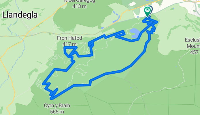


EC3
- 46 km
- 463 m
- 557 m
- Llandegla, Wales, United Kingdom
A cycling route starting in Llandegla, Wales, United Kingdom.
Overview
We did it! The red trail in the Coed Llandegla forest is behind us! This time Mr. Pelc joined Mr. Redl, and after delegating the girls for shopping, they headed to Wales. To properly test the new gear and heat up the brake discs to redness, we decided to choose the red trail for 'more advanced' bikers. As it turned out later, red quickly turned into black, and we blamed this state on Mr. Pelc's special perception of colors. But more on that later. Traditionally, we started by renting a bike and a helmet for Mr. Pelc. None fit. He has such a big head that we had to use duct tape to secure the helmet... A quick course on how to use the brakes, gears, and where the saddle and where the handlebars are. Sounds funny, but over there on the island, the brakes are reversed. Like most things. You can quickly find this out during a descent. If you go over the handlebars, you probably used the front brake with your right hand. Next time you'll remember, or you'll use both. Let's get to the point. Similar to the blue trail, we start with moderate climbs and forest paths. After a few minutes, we reach an open space, and from here, it is flatter and more picturesque. After 6 kilometers, we finally split from the relatively easy blue trail. And here the fun begins. First, we take a quick descent down a rocky road. You go so fast that it's easy to miss the left turn into the more technical terrain. There, ramps, roots, and sharp stones await us. After a moment, we regret that we don't have full-suspension bikes and large, soft gel saddles. After almost two kilometers of descending, braking, and splashing through the first muddy puddles, we reach the forest again. The climbs that would scare even Maja Włoszczowska do not impress us much and with smiles on our faces, we bring the bikes in (pedaling in our minds). Lots of technical descents, ramps, chutes, and MUD! For almost five kilometers we struggle with the increasingly interesting red trail. We cross intersections with the black trail several times, but we do not allow ourselves to be tempted. The black trail is coming to us! So let's go! 12 kilometers into the route, a quick drop, a few dangerous turns, and shortly after we land at an intersection where the path and bike tracks turn into a muddy, grassy sludge, and the post only shows a big BLACK arrow. Unfortunately, there was no way back. Up to now, we don't know what trail it is because we don't even have it on the maps. But it was prepared, with lots of narrow descents, steep climbs, ramps and jumps. There was even a bridge. When we reached the road where only pedestrians moved, we realized we were lost. No panic, we found the continuation of the red trail and set off down. A quick stop and a sip of water by the lake, and then only down to the end of the route. Next time we will be tempted by the full little black.)
created this 15 years ago
Continue with Bikemap
You would like to ride UK - COED LLANDEGLA FOREST (czerwona) or customize it for your own trip? Here is what you can do with this Bikemap route:
Free trial for 3 days, or one-time payment. More about Bikemap Premium.
Discover more Premium features.
Get Bikemap PremiumFrom our community
Open it in the app


