

Hovingham (Helperby) 2019-03-20
A cycling route starting in York, England, United Kingdom.
Overview
About this route
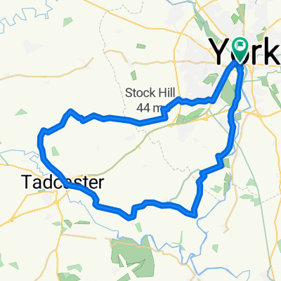
20/3/2019 – Ride 2b, Bryan S, Route: York / Overton / Beningborough / Newton & Linton on Ouse / Aldwark / Flawith / Helperby for elevenses at the Village Store. Helperby / Husthwaite / Coxwold / Gated road / Ampleforht / Ampleforth College via Back Lane / Thruogh the grounds / Gilling / Cawton / Stonegrave / Hovingham (Lunch at the Park Café. Hovingham / Coulton / Snargate Hill / Stearsby / Whenby / Sheriff Hutton / Strensall / Haxby / York Distance: 65 Miles.
- -:--
- Duration
- 102.1 km
- Distance
- 259 m
- Ascent
- 264 m
- Descent
- ---
- Avg. speed
- ---
- Max. altitude

Continue with Bikemap
Use, edit, or download this cycling route
You would like to ride Hovingham (Helperby) 2019-03-20 or customize it for your own trip? Here is what you can do with this Bikemap route:
Free features
- Save this route as favorite or in collections
- Copy & plan your own version of this route
- Split it into stages to create a multi-day tour
- Sync your route with Garmin or Wahoo
Premium features
Free trial for 3 days, or one-time payment. More about Bikemap Premium.
- Navigate this route on iOS & Android
- Export a GPX / KML file of this route
- Create your custom printout (try it for free)
- Download this route for offline navigation
Discover more Premium features.
Get Bikemap PremiumFrom our community
Other popular routes starting in York
 Beningborough short loop
- Distance
- 29.3 km
- Ascent
- 43 m
- Descent
- 44 m
- Location
- York, England, United Kingdom
 Fridaythorpe (Pockington) 2018-12-19
- Distance
- 84 km
- Ascent
- 395 m
- Descent
- 391 m
- Location
- York, England, United Kingdom
 York - Westow - York
- Distance
- 64.9 km
- Ascent
- 118 m
- Descent
- 114 m
- Location
- York, England, United Kingdom
 The Southern Loop
- Distance
- 43.2 km
- Ascent
- 72 m
- Descent
- 72 m
- Location
- York, England, United Kingdom
 37 Monkgate, York to 33 Huntington Road, York
- Distance
- 16.1 km
- Ascent
- 6 m
- Descent
- 13 m
- Location
- York, England, United Kingdom
 York to Newton-upon-Ouse
- Distance
- 17.5 km
- Ascent
- 693 m
- Descent
- 697 m
- Location
- York, England, United Kingdom
 Ampleforth (Malton) 2018-05-30
- Distance
- 114.9 km
- Ascent
- 353 m
- Descent
- 360 m
- Location
- York, England, United Kingdom
 York - Crayke - York via Easingwold
- Distance
- 63.9 km
- Ascent
- 117 m
- Descent
- 115 m
- Location
- York, England, United Kingdom
Open it in the app