

aguada
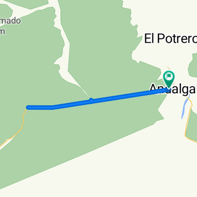
A cycling route starting in Andalgalá, Catamarca Province, Argentina.
Overview
About this route
- 38 min
- Duration
- 9.3 km
- Distance
- 194 m
- Ascent
- 218 m
- Descent
- 14.7 km/h
- Avg. speed
- ---
- Max. altitude

Route quality
Waytypes & surfaces along the route
Waytypes
Road
5 km
(54 %)
Track
1.3 km
(14 %)
Surfaces
Paved
4.3 km
(46 %)
Unpaved
4.7 km
(50 %)
Paved (undefined)
4.3 km
(46 %)
Unpaved (undefined)
2.9 km
(31 %)
Continue with Bikemap
Use, edit, or download this cycling route
You would like to ride aguada or customize it for your own trip? Here is what you can do with this Bikemap route:
Free features
- Save this route as favorite or in collections
- Copy & plan your own version of this route
- Sync your route with Garmin or Wahoo
Premium features
Free trial for 3 days, or one-time payment. More about Bikemap Premium.
- Navigate this route on iOS & Android
- Export a GPX / KML file of this route
- Create your custom printout (try it for free)
- Download this route for offline navigation
Discover more Premium features.
Get Bikemap PremiumFrom our community
Other popular routes starting in Andalgalá
 Andalgala - Santa Maria por Minas Capillitas
- Distance
- 143.1 km
- Ascent
- 2,345 m
- Descent
- 1,538 m
- Location
- Andalgalá, Catamarca Province, Argentina
 CAPILLITAS - ANDALAGA (POR AGUA RICA)
- Distance
- 67.8 km
- Ascent
- 3,478 m
- Descent
- 1,517 m
- Location
- Andalgalá, Catamarca Province, Argentina
 VUELTA ANDALGALA
- Distance
- 121.3 km
- Ascent
- 3,423 m
- Descent
- 3,429 m
- Location
- Andalgalá, Catamarca Province, Argentina
 Ruta moderata1
- Distance
- 48.6 km
- Ascent
- 198 m
- Descent
- 236 m
- Location
- Andalgalá, Catamarca Province, Argentina
 De Ruta Provincial 46, Andalgalá a Ruta Provincial 46, Andalgalá
- Distance
- 34.8 km
- Ascent
- 375 m
- Descent
- 368 m
- Location
- Andalgalá, Catamarca Province, Argentina
 Ascensos en Catamarca
- Distance
- 971.2 km
- Ascent
- 7,696 m
- Descent
- 7,939 m
- Location
- Andalgalá, Catamarca Province, Argentina
 Etapa 3 Andalgala a Refugio del Minero
- Distance
- 57.2 km
- Ascent
- 2,381 m
- Descent
- 572 m
- Location
- Andalgalá, Catamarca Province, Argentina
 Etapa 2 Buena Vista a Andalgala
- Distance
- 54 km
- Ascent
- 491 m
- Descent
- 1,047 m
- Location
- Andalgalá, Catamarca Province, Argentina
Open it in the app