

RR Radeberg, Dresden
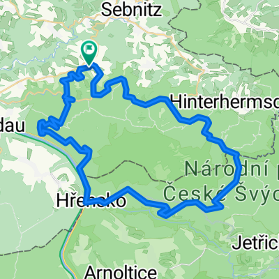
A cycling route starting in Sebnitz, Saxony, Germany.
Overview
About this route
Nette Trainingsrunde über einige Hügel und auch größere flache Passagen. Schöne Natur, kleine Dörfer und als Kontrast dazu die Kulturstadt Dresden.
Der Belag ist zum überwiegenden Teil schön fahrbar, wenngleich es einige Abschnitte gibt, bei denen einem die Trinkflasche aus dem Halter hüpft. Auf die Idee, dass man die Strecke auch anders legen könnte bin ich schon vorher gekommen, es darf also eine gewisse Vorsätzlichkeit unterstellt werden, jedoch wurde mangels Streckenkenntnis am (ungefähren) Plan festgehalten. Wenn also jemand einen Wink mit dem Zaunspfahl für eine materialschonendere Wegführung hat, dann bitte her damit.
- -:--
- Duration
- 123.2 km
- Distance
- 567 m
- Ascent
- 567 m
- Descent
- ---
- Avg. speed
- ---
- Avg. speed

Route quality
Waytypes & surfaces along the route
Waytypes
Busy road
37.5 km
(30 %)
Road
30.7 km
(25 %)
Surfaces
Paved
97.6 km
(79 %)
Unpaved
2 km
(2 %)
Asphalt
93.6 km
(76 %)
Paving stones
3.3 km
(3 %)
Continue with Bikemap
Use, edit, or download this cycling route
You would like to ride RR Radeberg, Dresden or customize it for your own trip? Here is what you can do with this Bikemap route:
Free features
- Save this route as favorite or in collections
- Copy & plan your own version of this route
- Split it into stages to create a multi-day tour
- Sync your route with Garmin or Wahoo
Premium features
Free trial for 3 days, or one-time payment. More about Bikemap Premium.
- Navigate this route on iOS & Android
- Export a GPX / KML file of this route
- Create your custom printout (try it for free)
- Download this route for offline navigation
Discover more Premium features.
Get Bikemap PremiumFrom our community
Other popular routes starting in Sebnitz
 Sebnitz - Kyjov - Sebnitz
- Distance
- 43.9 km
- Ascent
- 608 m
- Descent
- 608 m
- Location
- Sebnitz, Saxony, Germany
 Zeughaus, Zeidlertal, Tanzplan
- Distance
- 46.2 km
- Ascent
- 696 m
- Descent
- 697 m
- Location
- Sebnitz, Saxony, Germany
 Kleines Prebischtor, Var. 2
- Distance
- 46.8 km
- Ascent
- 586 m
- Descent
- 586 m
- Location
- Sebnitz, Saxony, Germany
 Hinterhermsdorf-Panoramaweg-Bad Schandau-Nationalpark
- Distance
- 46.1 km
- Ascent
- 693 m
- Descent
- 693 m
- Location
- Sebnitz, Saxony, Germany
 110 km Sparkassen Panorama- RADtour
- Distance
- 101.1 km
- Ascent
- 1,097 m
- Descent
- 1,097 m
- Location
- Sebnitz, Saxony, Germany
 Hinterhermsdorf - Ruppersdorf
- Distance
- 65.6 km
- Ascent
- 571 m
- Descent
- 618 m
- Location
- Sebnitz, Saxony, Germany
 Gipfeltour, hart aber schön
- Distance
- 106 km
- Ascent
- 1,851 m
- Descent
- 1,851 m
- Location
- Sebnitz, Saxony, Germany
 Zwischen Kirnitzschtal und Balzhütten
- Distance
- 38 km
- Ascent
- 415 m
- Descent
- 415 m
- Location
- Sebnitz, Saxony, Germany
Open it in the app