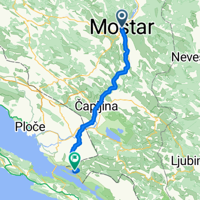
Ciro Ruta
A cycling route starting in Mostar, Federation of Bosnia and Herzegovina, Bosnia and Herzegovina.
Overview
About this route
-
Ulazak na makadam stazu odma posle Draceva do Donjeg Zelenikovca
-
Ulazak na makadam stazu odma posle Ravnog do Zavale
- -:--
- Duration
- 141 km
- Distance
- 525 m
- Ascent
- 320 m
- Descent
- ---
- Avg. speed
- ---
- Avg. speed
Route quality
Waytypes & surfaces along the route
Waytypes
Busy road
90.4 km
(64 %)
Quiet road
34.9 km
(25 %)
Surfaces
Paved
127.1 km
(90 %)
Unpaved
0.1 km
(<1 %)
Asphalt
118.8 km
(84 %)
Paved (undefined)
8.3 km
(6 %)
Continue with Bikemap
Use, edit, or download this cycling route
You would like to ride Ciro Ruta or customize it for your own trip? Here is what you can do with this Bikemap route:
Free features
- Save this route as favorite or in collections
- Copy & plan your own version of this route
- Sync your route with Garmin or Wahoo
Premium features
Free trial for 3 days, or one-time payment. More about Bikemap Premium.
- Navigate this route on iOS & Android
- Export a GPX / KML file of this route
- Create your custom printout (try it for free)
- Download this route for offline navigation
Discover more Premium features.
Get Bikemap PremiumFrom our community
Other popular routes starting in Mostar
- Otvaranje-sezone-2021
- Distance
- 57.9 km
- Ascent
- 979 m
- Descent
- 980 m
- Location
- Mostar, Federation of Bosnia and Herzegovina, Bosnia and Herzegovina
- Biking with Stars - 2.prijedlog
- Distance
- 8.5 km
- Ascent
- 105 m
- Descent
- 105 m
- Location
- Mostar, Federation of Bosnia and Herzegovina, Bosnia and Herzegovina
- 11 - ECT 2013 - MOSTAR - DUBROVNIK (140km)
- Distance
- 138.1 km
- Ascent
- 713 m
- Descent
- 777 m
- Location
- Mostar, Federation of Bosnia and Herzegovina, Bosnia and Herzegovina
- Mostar - Blace
- Distance
- 71.9 km
- Ascent
- 649 m
- Descent
- 713 m
- Location
- Mostar, Federation of Bosnia and Herzegovina, Bosnia and Herzegovina
- Route zu Konjic
- Distance
- 104.5 km
- Ascent
- 4,217 m
- Descent
- 3,990 m
- Location
- Mostar, Federation of Bosnia and Herzegovina, Bosnia and Herzegovina
- Zalik - Podvelež - Gnojnice - Zalik
- Distance
- 48.2 km
- Ascent
- 803 m
- Descent
- 814 m
- Location
- Mostar, Federation of Bosnia and Herzegovina, Bosnia and Herzegovina
- Mostar-Kameni vinogradi
- Distance
- 86.5 km
- Ascent
- 923 m
- Descent
- 929 m
- Location
- Mostar, Federation of Bosnia and Herzegovina, Bosnia and Herzegovina
- Mostar Podveležje Buna Mostar
- Distance
- 63.4 km
- Ascent
- 951 m
- Descent
- 951 m
- Location
- Mostar, Federation of Bosnia and Herzegovina, Bosnia and Herzegovina
Open it in the app