

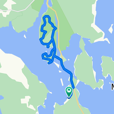
Etape 26 Sulkava - Puumala
A cycling route starting in Sulkava, South Savo, Finland.
Overview
About this route
Saimaa lake
- -:--
- Duration
- 48.1 km
- Distance
- 308 m
- Ascent
- 316 m
- Descent
- ---
- Avg. speed
- ---
- Max. altitude

Route quality
Waytypes & surfaces along the route
Waytypes
Road
40.9 km
(85 %)
Cycleway
1.9 km
(4 %)
Undefined
5.3 km
(11 %)
Surfaces
Paved
47.7 km
(99 %)
Asphalt
41.9 km
(87 %)
Paved (undefined)
5.8 km
(12 %)
Undefined
0.5 km
(1 %)
Continue with Bikemap
Use, edit, or download this cycling route
You would like to ride Etape 26 Sulkava - Puumala or customize it for your own trip? Here is what you can do with this Bikemap route:
Free features
- Save this route as favorite or in collections
- Copy & plan your own version of this route
- Sync your route with Garmin or Wahoo
Premium features
Free trial for 3 days, or one-time payment. More about Bikemap Premium.
- Navigate this route on iOS & Android
- Export a GPX / KML file of this route
- Create your custom printout (try it for free)
- Download this route for offline navigation
Discover more Premium features.
Get Bikemap PremiumFrom our community
Other popular routes starting in Sulkava
 Etape 26 Sulkava - Puumala
- Distance
- 48.1 km
- Ascent
- 308 m
- Descent
- 316 m
- Location
- Sulkava, South Savo, Finland
 Sulkava - Savonlinna (Hotel Saima)
- Distance
- 44.5 km
- Ascent
- 272 m
- Descent
- 269 m
- Location
- Sulkava, South Savo, Finland
 Saajuuntie 520–528, Kaartilankoski to Saajuuntie 437–483, Kaartilankoski
- Distance
- 17.7 km
- Ascent
- 703 m
- Descent
- 704 m
- Location
- Sulkava, South Savo, Finland
 Saajuuntie 530–534, Kaartilankoski to Saajuuntie 119–315, Kaartilankoski
- Distance
- 8.7 km
- Ascent
- 428 m
- Descent
- 423 m
- Location
- Sulkava, South Savo, Finland
 matka
matka- Distance
- 26.9 km
- Ascent
- 214 m
- Descent
- 217 m
- Location
- Sulkava, South Savo, Finland
 Kirkkotie 140, Sulkava to Eerikinkatu 6–8, Savonlinna
- Distance
- 47.7 km
- Ascent
- 781 m
- Descent
- 821 m
- Location
- Sulkava, South Savo, Finland
 Route in Sulkava
- Distance
- 9.5 km
- Ascent
- 205 m
- Descent
- 205 m
- Location
- Sulkava, South Savo, Finland
 Ryhälä - Punkaharju
- Distance
- 91.8 km
- Ascent
- 351 m
- Descent
- 355 m
- Location
- Sulkava, South Savo, Finland
Open it in the app