

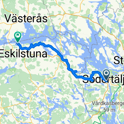
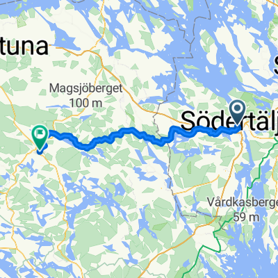
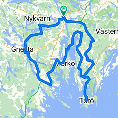
rando2
A cycling route starting in Södertälje, Stockholm County, Sweden.
Overview
About this route
- -:--
- Duration
- 205.7 km
- Distance
- 452 m
- Ascent
- 452 m
- Descent
- ---
- Avg. speed
- ---
- Max. altitude

Route quality
Waytypes & surfaces along the route
Waytypes
Road
72 km
(35 %)
Cycleway
12.3 km
(6 %)
Surfaces
Paved
193.4 km
(94 %)
Unpaved
4.1 km
(2 %)
Asphalt
174.8 km
(85 %)
Paved (undefined)
18.5 km
(9 %)
Continue with Bikemap
Use, edit, or download this cycling route
You would like to ride rando2 or customize it for your own trip? Here is what you can do with this Bikemap route:
Free features
- Save this route as favorite or in collections
- Copy & plan your own version of this route
- Split it into stages to create a multi-day tour
- Sync your route with Garmin or Wahoo
Premium features
Free trial for 3 days, or one-time payment. More about Bikemap Premium.
- Navigate this route on iOS & Android
- Export a GPX / KML file of this route
- Create your custom printout (try it for free)
- Download this route for offline navigation
Discover more Premium features.
Get Bikemap PremiumFrom our community
Other popular routes starting in Södertälje

Edge 820®
Södertälje Cycling- Distance
- 27.5 km
- Ascent
- 345 m
- Descent
- 350 m
- Location
- Södertälje, Stockholm County, Sweden
 season opening
- Distance
- 33.8 km
- Ascent
- 456 m
- Descent
- 457 m
- Location
- Södertälje, Stockholm County, Sweden
 Södertälje to Nygatan, Strängnäs
- Distance
- 57.5 km
- Ascent
- 587 m
- Descent
- 579 m
- Location
- Södertälje, Stockholm County, Sweden
 Vagnhärad - Stockholm
- Distance
- 39.9 km
- Ascent
- 430 m
- Descent
- 427 m
- Location
- Södertälje, Stockholm County, Sweden
 Södertälje - Mälarbaden etapp syd
- Distance
- 113.5 km
- Ascent
- 959 m
- Descent
- 961 m
- Location
- Södertälje, Stockholm County, Sweden
 Södertälje centrum naar Torggatan
- Distance
- 76.9 km
- Ascent
- 977 m
- Descent
- 936 m
- Location
- Södertälje, Stockholm County, Sweden
 Kakslottet
- Distance
- 25.4 km
- Ascent
- 299 m
- Descent
- 326 m
- Location
- Södertälje, Stockholm County, Sweden
 rando2
- Distance
- 205.7 km
- Ascent
- 452 m
- Descent
- 452 m
- Location
- Södertälje, Stockholm County, Sweden
Open it in the app