

Intersection of RN51/RN40 to La Poma through Abra del Acay
A cycling route starting in San Antonio de los Cobres, Salta Province, Argentina.
Overview
About this route
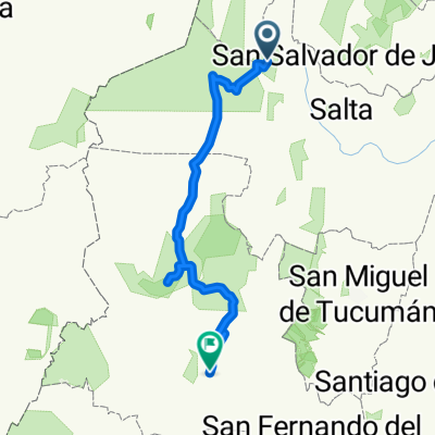
Incredible path that connects the intersection of the national routes 40 and 51, and La Poma, climbing the highest road path of the Americas called Abra del Acay (4900 mts).
- -:--
- Duration
- 75.4 km
- Distance
- 1,118 m
- Ascent
- 1,951 m
- Descent
- ---
- Avg. speed
- ---
- Max. altitude
Continue with Bikemap
Use, edit, or download this cycling route
You would like to ride Intersection of RN51/RN40 to La Poma through Abra del Acay or customize it for your own trip? Here is what you can do with this Bikemap route:
Free features
- Save this route as favorite or in collections
- Copy & plan your own version of this route
- Sync your route with Garmin or Wahoo
Premium features
Free trial for 3 days, or one-time payment. More about Bikemap Premium.
- Navigate this route on iOS & Android
- Export a GPX / KML file of this route
- Create your custom printout (try it for free)
- Download this route for offline navigation
Discover more Premium features.
Get Bikemap PremiumFrom our community
Other popular routes starting in San Antonio de los Cobres
 Intersection of RN51/RN40 to La Poma through Abra del Acay
- Distance
- 75.4 km
- Ascent
- 1,118 m
- Descent
- 1,951 m
- Location
- San Antonio de los Cobres, Salta Province, Argentina
 SAC-LPV-SAC 35k
- Distance
- 35.3 km
- Ascent
- 490 m
- Descent
- 490 m
- Location
- San Antonio de los Cobres, Salta Province, Argentina
 Sant Antonio de los Cobres a La Rioja
- Distance
- 781.2 km
- Ascent
- 2,762 m
- Descent
- 6,011 m
- Location
- San Antonio de los Cobres, Salta Province, Argentina
 El Acay 2011 2º etapa: RN40 Km 4627,5 - La Poma
- Distance
- 72.8 km
- Ascent
- 1,046 m
- Descent
- 1,946 m
- Location
- San Antonio de los Cobres, Salta Province, Argentina
 SAC - Antofagasta - Belen
- Distance
- 684.8 km
- Ascent
- 3,291 m
- Descent
- 5,776 m
- Location
- San Antonio de los Cobres, Salta Province, Argentina
 San Antonio de los Cobes - Salta
- Distance
- 164.2 km
- Ascent
- 380 m
- Descent
- 2,964 m
- Location
- San Antonio de los Cobres, Salta Province, Argentina
 ABRA DEL ACAY
- Distance
- 130.1 km
- Ascent
- 1,177 m
- Descent
- 2,485 m
- Location
- San Antonio de los Cobres, Salta Province, Argentina
 4 san antonio de los cobres - CACHI
- Distance
- 132.4 km
- Ascent
- 1,252 m
- Descent
- 2,659 m
- Location
- San Antonio de los Cobres, Salta Province, Argentina
Open it in the app