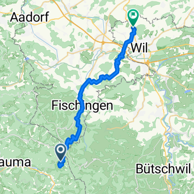
From Fischenthal to Wil SG
- 23.6 km
- 698 m
- 1,212 m
- Bauma, Canton of Zurich, Switzerland
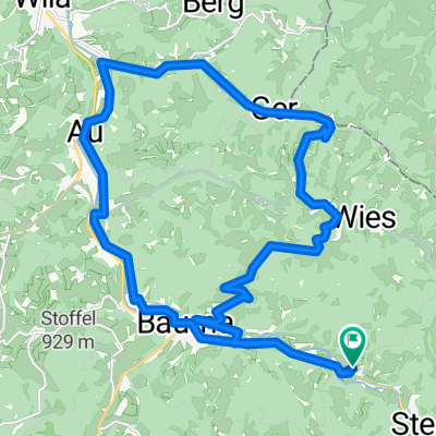
A cycling route starting in Bauma, Canton of Zurich, Switzerland.
Overview
Beautiful mountain biking tour in the Zurich Oberland. Medium difficulty level with some very steep sections (15-20%).
Height difference 1100m
Travel time approximately 3h 15min
Elevation data on this map is not exact, as contour lines were traced with the cursor.
Route described in detail, among others, in the book 'Mountainbike-Erlebnis' by V. Eggenberger (Climbe & Bike Edition 1995)
created this 17 years ago
Route highlights

Schnebelhorn 1291m.ü.M. Bild: Source Wikipedia.org
Continue with Bikemap
You would like to ride Bauma-Schnebelhorn or customize it for your own trip? Here is what you can do with this Bikemap route:
Free trial for 3 days, or one-time payment. More about Bikemap Premium.
Discover more Premium features.
Get Bikemap PremiumFrom our community
Open it in the app