
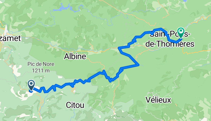
Pradelles-Cabardès - Saint-Pons-de-Thomières
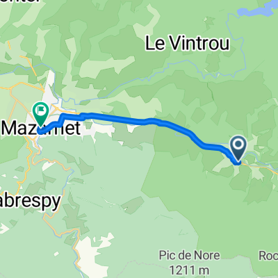
A cycling route starting in Saint-Amans-Soult, Occitanie, France.
Overview
About this route
- -:--
- Duration
- 59 km
- Distance
- 757 m
- Ascent
- 1,260 m
- Descent
- ---
- Avg. speed
- ---
- Max. altitude

Route photos

Route quality
Waytypes & surfaces along the route
Waytypes
Road
30.1 km
(51 %)
Quiet road
1.8 km
(3 %)
Surfaces
Paved
10 km
(17 %)
Unpaved
1.8 km
(3 %)
Asphalt
10 km
(17 %)
Ground
1.8 km
(3 %)
Undefined
47.2 km
(80 %)
Continue with Bikemap
Use, edit, or download this cycling route
You would like to ride Pradelles-Cabardès - Saint-Pons-de-Thomières or customize it for your own trip? Here is what you can do with this Bikemap route:
Free features
- Save this route as favorite or in collections
- Copy & plan your own version of this route
- Sync your route with Garmin or Wahoo
Premium features
Free trial for 3 days, or one-time payment. More about Bikemap Premium.
- Navigate this route on iOS & Android
- Export a GPX / KML file of this route
- Create your custom printout (try it for free)
- Download this route for offline navigation
Discover more Premium features.
Get Bikemap PremiumFrom our community
Other popular routes starting in Saint-Amans-Soult
 Route Albine 1
- Distance
- 109.6 km
- Ascent
- 1,751 m
- Descent
- 1,758 m
- Location
- Saint-Amans-Soult, Occitanie, France
 triby peyremaux bt pont
- Distance
- 38.2 km
- Ascent
- 408 m
- Descent
- 1,109 m
- Location
- Saint-Amans-Soult, Occitanie, France
 Passa pais
- Distance
- 87.3 km
- Ascent
- 381 m
- Descent
- 462 m
- Location
- Saint-Amans-Soult, Occitanie, France
 Pic de Nore - Villegly
- Distance
- 30.8 km
- Ascent
- 473 m
- Descent
- 1,406 m
- Location
- Saint-Amans-Soult, Occitanie, France
 france 2009-10 pradelles cabardès-amrissan
- Distance
- 97.2 km
- Ascent
- 540 m
- Descent
- 1,290 m
- Location
- Saint-Amans-Soult, Occitanie, France
 étape 3
- Distance
- 10.8 km
- Ascent
- 59 m
- Descent
- 91 m
- Location
- Saint-Amans-Soult, Occitanie, France
 Pradelles-Cabardès - Saint-Pons-de-Thomières
- Distance
- 59 km
- Ascent
- 757 m
- Descent
- 1,260 m
- Location
- Saint-Amans-Soult, Occitanie, France
 Route Albine 3
- Distance
- 124.3 km
- Ascent
- 1,246 m
- Descent
- 1,245 m
- Location
- Saint-Amans-Soult, Occitanie, France
Open it in the app