Sante Sabide
A cycling route starting in Latisana, Friuli Venezia Giulia, Italy.
Overview
About this route
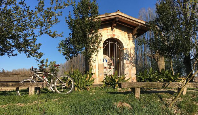
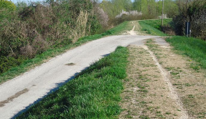
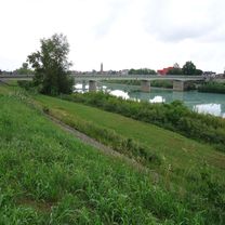
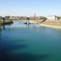
Anello, con partenza dalla stazione di Latisana, che risale il Tagliamento lungo l’argine sinistro fino al ponte di Madrisio e poi torna a Latisana sull’argine sinistro. Poco oltre l’A4, prima di Fraforeano, sulla destra l’edicola dedicata a “Sante Sabide”, la santa mai esistita.
- -:--
- Duration
- 30.7 km
- Distance
- 13 m
- Ascent
- 11 m
- Descent
- ---
- Avg. speed
- ---
- Avg. speed
Route photos
Route quality
Waytypes & surfaces along the route
Waytypes
Track
11.6 km
(38 %)
Cycleway
5.3 km
(17 %)
Surfaces
Paved
7.8 km
(25 %)
Unpaved
12.6 km
(41 %)
Asphalt
7 km
(23 %)
Unpaved (undefined)
6.3 km
(20 %)
Continue with Bikemap
Use, edit, or download this cycling route
You would like to ride Sante Sabide or customize it for your own trip? Here is what you can do with this Bikemap route:
Free features
- Save this route as favorite or in collections
- Copy & plan your own version of this route
- Sync your route with Garmin or Wahoo
Premium features
Free trial for 3 days, or one-time payment. More about Bikemap Premium.
- Navigate this route on iOS & Android
- Export a GPX / KML file of this route
- Create your custom printout (try it for free)
- Download this route for offline navigation
Discover more Premium features.
Get Bikemap PremiumFrom our community
Other popular routes starting in Latisana
 Da Via Sottopovolo 58, Latisana a Via Nazario Sauro 42, Latisana
- Distance
- 41.3 km
- Ascent
- 3 m
- Descent
- 10 m
- Location
- Latisana, Friuli Venezia Giulia, Italy
 10-Latinasia-Monfalcone
- Distance
- 49.7 km
- Ascent
- 37 m
- Descent
- 38 m
- Location
- Latisana, Friuli Venezia Giulia, Italy
 ciclo
ciclo- Distance
- 5.3 km
- Ascent
- 114 m
- Descent
- 146 m
- Location
- Latisana, Friuli Venezia Giulia, Italy
 2017_Wien Roma Tag03 Latisana Rimini
- Distance
- 252.4 km
- Ascent
- 14 m
- Descent
- 22 m
- Location
- Latisana, Friuli Venezia Giulia, Italy
 LATISANA - OTTAVA PRESA
- Distance
- 51 km
- Ascent
- 13 m
- Descent
- 13 m
- Location
- Latisana, Friuli Venezia Giulia, Italy
 Tappa 9a - 7 agosto
- Distance
- 1.2 km
- Ascent
- 0 m
- Descent
- 0 m
- Location
- Latisana, Friuli Venezia Giulia, Italy
 2018-06-01
- Distance
- 81.7 km
- Ascent
- 11 m
- Descent
- 19 m
- Location
- Latisana, Friuli Venezia Giulia, Italy
 Pistino a Camino
- Distance
- 56.4 km
- Ascent
- 37 m
- Descent
- 38 m
- Location
- Latisana, Friuli Venezia Giulia, Italy
Open it in the app


