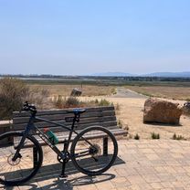
PA -> SRWC
A cycling route starting in Palo Alto, California, United States.
Overview
About this route
- -:--
- Duration
- 11.4 km
- Distance
- 12 m
- Ascent
- 17 m
- Descent
- ---
- Avg. speed
- ---
- Max. altitude
Route quality
Waytypes & surfaces along the route
Waytypes
Road
5.2 km
(46 %)
Quiet road
4 km
(35 %)
Surfaces
Paved
7.4 km
(65 %)
Asphalt
7.4 km
(65 %)
Undefined
4 km
(35 %)
Continue with Bikemap
Use, edit, or download this cycling route
You would like to ride PA -> SRWC or customize it for your own trip? Here is what you can do with this Bikemap route:
Free features
- Save this route as favorite or in collections
- Copy & plan your own version of this route
- Sync your route with Garmin or Wahoo
Premium features
Free trial for 3 days, or one-time payment. More about Bikemap Premium.
- Navigate this route on iOS & Android
- Export a GPX / KML file of this route
- Create your custom printout (try it for free)
- Download this route for offline navigation
Discover more Premium features.
Get Bikemap PremiumFrom our community
Other popular routes starting in Palo Alto
Portola + Canada Loop- Distance
- 59.6 km
- Ascent
- 444 m
- Descent
- 444 m
- Location
- Palo Alto, California, United States
Route to Stanford Hospital- Distance
- 8 km
- Ascent
- 32 m
- Descent
- 8 m
- Location
- Palo Alto, California, United States
Shoreline Park Trail, Mountain View to Nicholas Dr, Mountain View- Distance
- 20.1 km
- Ascent
- 68 m
- Descent
- 45 m
- Location
- Palo Alto, California, United States
PA -> SRWC- Distance
- 11.4 km
- Ascent
- 12 m
- Descent
- 17 m
- Location
- Palo Alto, California, United States
Edgewood Drive to Edgewood Drive- Distance
- 34.2 km
- Ascent
- 386 m
- Descent
- 330 m
- Location
- Palo Alto, California, United States
Addison Ave, パロアルトへJane Stanford Way, スタンフォード- Distance
- 3.1 km
- Ascent
- 19 m
- Descent
- 10 m
- Location
- Palo Alto, California, United States
shoreline lake route in Mountain View- Distance
- 9.6 km
- Ascent
- 24 m
- Descent
- 20 m
- Location
- Palo Alto, California, United States
Portola and Altamont- Distance
- 43.5 km
- Ascent
- 560 m
- Descent
- 553 m
- Location
- Palo Alto, California, United States
Open it in the app

