

Böhler/homberg
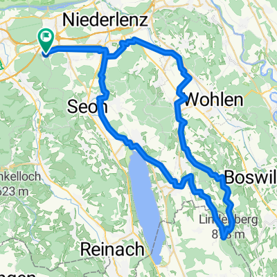
A cycling route starting in Schafisheim, Canton of Aargau, Switzerland.
Overview
About this route
- -:--
- Duration
- 56.1 km
- Distance
- 931 m
- Ascent
- 935 m
- Descent
- ---
- Avg. speed
- ---
- Max. altitude

Route quality
Waytypes & surfaces along the route
Waytypes
Track
25.8 km
(46 %)
Quiet road
14 km
(25 %)
Surfaces
Paved
12.3 km
(22 %)
Unpaved
27.5 km
(49 %)
Gravel
19.6 km
(35 %)
Asphalt
9 km
(16 %)
Route highlights
Points of interest along the route
Drinking water after 7.8 km
Point of interest after 9.1 km
trail#1
Point of interest after 9.5 km
Trai#2
Point of interest after 9.8 km
Trail#3
Point of interest after 10.9 km
Trail#4
Drinking water after 12.1 km
Point of interest after 13.4 km
Hard uphill #1
Point of interest after 14.1 km
Trail #5
Point of interest after 16.5 km
Hard uphill #2
Point of interest after 16.8 km
Trail #6
Point of interest after 17.9 km
Trail #7
Point of interest after 18.6 km
Start Böhler downhill
Point of interest after 26.6 km
Trail #8
Drinking water after 26.7 km
Point of interest after 28.7 km
Trail #9
Point of interest after 29.6 km
Trail# 10
Point of interest after 30.3 km
Trail #11
Point of interest after 32.8 km
Mittagessen/ Akku laden
Point of interest after 35.9 km
150 M fahrverbot
Point of interest after 37.9 km
Trail #12
Drinking water after 40.6 km
Point of interest after 44.1 km
Start Homberg downhill
Drinking water after 47.6 km
Continue with Bikemap
Use, edit, or download this cycling route
You would like to ride Böhler/homberg or customize it for your own trip? Here is what you can do with this Bikemap route:
Free features
- Save this route as favorite or in collections
- Copy & plan your own version of this route
- Sync your route with Garmin or Wahoo
Premium features
Free trial for 3 days, or one-time payment. More about Bikemap Premium.
- Navigate this route on iOS & Android
- Export a GPX / KML file of this route
- Create your custom printout (try it for free)
- Download this route for offline navigation
Discover more Premium features.
Get Bikemap PremiumFrom our community
Other popular routes starting in Schafisheim
 Böhler/homberg
- Distance
- 56.1 km
- Ascent
- 931 m
- Descent
- 935 m
- Location
- Schafisheim, Canton of Aargau, Switzerland
 Lenzburg - Erlinsbach (SO)
- Distance
- 21.1 km
- Ascent
- 268 m
- Descent
- 272 m
- Location
- Schafisheim, Canton of Aargau, Switzerland
 MTB Home-FC Stockhard
- Distance
- 4.1 km
- Ascent
- 19 m
- Descent
- 56 m
- Location
- Schafisheim, Canton of Aargau, Switzerland
 MTB Rüttihof-Wannenhof-Staffelegg
- Distance
- 36.2 km
- Ascent
- 592 m
- Descent
- 592 m
- Location
- Schafisheim, Canton of Aargau, Switzerland
 Gisliflue
- Distance
- 27.6 km
- Ascent
- 488 m
- Descent
- 488 m
- Location
- Schafisheim, Canton of Aargau, Switzerland
 Hunzenschwil - Erlinsbach (SO)
- Distance
- 21.2 km
- Ascent
- 1,664 m
- Descent
- 1,669 m
- Location
- Schafisheim, Canton of Aargau, Switzerland
 RV Freiamt - Schafisheim, Muri, Sins, Inwil, Hochdorf, Meisterschwanden, Seengen, Egliswil
- Distance
- 82.9 km
- Ascent
- 492 m
- Descent
- 444 m
- Location
- Schafisheim, Canton of Aargau, Switzerland
 5707-5615-5618-LINDENBERG FELDMOOSWEIHERE
- Distance
- 55.4 km
- Ascent
- 849 m
- Descent
- 849 m
- Location
- Schafisheim, Canton of Aargau, Switzerland
Open it in the app