Rundfahrt Valpolicella 1 / Negar
A cycling route starting in Arbizzano-Santa Maria, Veneto, Italy.
Overview
About this route
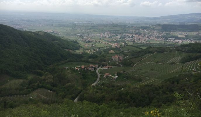
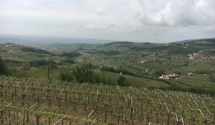
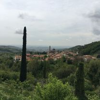
Die Route führt höhenwegartig um die Gemeinde Negrar. Sie führt auf Höhenwege, zwischen Rebberge und auch an Orten mit einer tollen Aussicht. Es gibt gute Möglichkeiten, um die Route zu kürzen oder zu verlängern, je nach Kondition und Laune.
Beschreibung: In St. Maria gibt es gute Parkmöglichkeiten. Danach fährt man auf der Hauptstrasse ca. 1 km nach Pedemonte, um anschliessend über den reizvollen und teils bepflasterten Höhenweg bis zur Abzweigung nach Valgatara zu fahren. Hier ist ein MTB eindeutig von Vorteil. Kurz vor Marano die Valpolicella entscheidet man sich für den unbefestigten Weg (rechts abzweigen) oder für die Variante mit Zwischenhalt in Marano (auf der befestigten Strasse bleiben). Zwischen Ca'Camporal und Turbe lohnt sich der schönen Aussicht wegen ein kurzer Zwischenhalt. Nach dem Erreichen des höchsten Punktes ob Fane gilt es nach kurzer Abfahrt und dem Geniessen der Aussicht nach Lugo die Abzweigung rechts nicht zu verpassen. Weitere Stellen mit einer tollen Aussicht sind in Collombare die Villa und in Dondole. Nach Dondole geht es ziemlich steil, aber auf befestigter Strasse, runter nach Nagrar und zurück nach Santa Maria.
Hinweis: Die Route kann auch umgekehrt gefahren werden. Als grosse Herausforderung gilt im diesen Fall der Anstieg zwischen Siresol und Dondole, welcher konditionell einiges abverlangt.
- -:--
- Duration
- 37.9 km
- Distance
- 888 m
- Ascent
- 888 m
- Descent
- ---
- Avg. speed
- ---
- Max. altitude
Route photos
Route quality
Waytypes & surfaces along the route
Waytypes
Quiet road
15.9 km
(42 %)
Road
14.5 km
(38 %)
Surfaces
Paved
33 km
(87 %)
Unpaved
2.2 km
(6 %)
Asphalt
32.5 km
(86 %)
Pebblestone
1.6 km
(4 %)
Route highlights
Points of interest along the route
Photo after 14.1 km
Aussichtspunkt 1
Photo after 22.6 km
Aussichtspunkt
Photo after 26.2 km
Aussichtspunkt 2
Continue with Bikemap
Use, edit, or download this cycling route
You would like to ride Rundfahrt Valpolicella 1 / Negar or customize it for your own trip? Here is what you can do with this Bikemap route:
Free features
- Save this route as favorite or in collections
- Copy & plan your own version of this route
- Sync your route with Garmin or Wahoo
Premium features
Free trial for 3 days, or one-time payment. More about Bikemap Premium.
- Navigate this route on iOS & Android
- Export a GPX / KML file of this route
- Create your custom printout (try it for free)
- Download this route for offline navigation
Discover more Premium features.
Get Bikemap PremiumFrom our community
Other popular routes starting in Arbizzano-Santa Maria
 Anello Valpolicella 2
- Distance
- 32.3 km
- Ascent
- 453 m
- Descent
- 452 m
- Location
- Arbizzano-Santa Maria, Veneto, Italy
 Negrar - Ponte di Veja - Fosse
- Distance
- 58.9 km
- Ascent
- 1,165 m
- Descent
- 1,165 m
- Location
- Arbizzano-Santa Maria, Veneto, Italy
 percorso 29 apr 23
- Distance
- 29.9 km
- Ascent
- 244 m
- Descent
- 242 m
- Location
- Arbizzano-Santa Maria, Veneto, Italy
 Cla Verona e bassa Valpolicella
- Distance
- 28.2 km
- Ascent
- 100 m
- Descent
- 99 m
- Location
- Arbizzano-Santa Maria, Veneto, Italy
 Anello Arbizzano - Peschiera - Arbizzano
- Distance
- 60.1 km
- Ascent
- 487 m
- Descent
- 489 m
- Location
- Arbizzano-Santa Maria, Veneto, Italy
 Promo Valpolicella Tour
- Distance
- 18.2 km
- Ascent
- 198 m
- Descent
- 196 m
- Location
- Arbizzano-Santa Maria, Veneto, Italy
 Cla da Valpolicella a lago di Garda
- Distance
- 64.3 km
- Ascent
- 613 m
- Descent
- 614 m
- Location
- Arbizzano-Santa Maria, Veneto, Italy
 Percorso recente giro Valpolicella
- Distance
- 31.7 km
- Ascent
- 220 m
- Descent
- 218 m
- Location
- Arbizzano-Santa Maria, Veneto, Italy
Open it in the app


