

Tag 4 Mont Ventoux
A cycling route starting in Châtillon, Auvergne-Rhône-Alpes, France.
Overview
About this route
Hotel Les Portes du Vercors
8 Boulevard Gambetta, Saint-Marcellin, 38160, France +33476382431
20.06-21.06
- -:--
- Duration
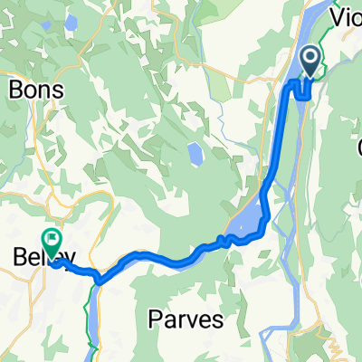
- 103 km
- Distance
- 586 m
- Ascent
- 541 m
- Descent
- ---
- Avg. speed
- ---
- Max. altitude

Route quality
Waytypes & surfaces along the route
Waytypes
Road
12.4 km
(12 %)
Quiet road
9.3 km
(9 %)
Surfaces
Paved
35 km
(34 %)
Unpaved
2.1 km
(2 %)
Asphalt
35 km
(34 %)
Gravel
1 km
(1 %)
Continue with Bikemap
Use, edit, or download this cycling route
You would like to ride Tag 4 Mont Ventoux or customize it for your own trip? Here is what you can do with this Bikemap route:
Free features
- Save this route as favorite or in collections
- Copy & plan your own version of this route
- Split it into stages to create a multi-day tour
- Sync your route with Garmin or Wahoo
Premium features
Free trial for 3 days, or one-time payment. More about Bikemap Premium.
- Navigate this route on iOS & Android
- Export a GPX / KML file of this route
- Create your custom printout (try it for free)
- Download this route for offline navigation
Discover more Premium features.
Get Bikemap PremiumFrom our community
Other popular routes starting in Châtillon
 Etape 3 (58km) - Camping de Chanaz à celui de Morestel
- Distance
- 58.4 km
- Ascent
- 263 m
- Descent
- 284 m
- Location
- Châtillon, Auvergne-Rhône-Alpes, France
 Alpen 2015 - Dag 5
- Distance
- 95.9 km
- Ascent
- 2,079 m
- Descent
- 1,865 m
- Location
- Châtillon, Auvergne-Rhône-Alpes, France
 chanazJongieuChanaz
- Distance
- 37.5 km
- Ascent
- 1,135 m
- Descent
- 1,143 m
- Location
- Châtillon, Auvergne-Rhône-Alpes, France
 Tour des lacs étape 3
- Distance
- 60.8 km
- Ascent
- 525 m
- Descent
- 356 m
- Location
- Châtillon, Auvergne-Rhône-Alpes, France
 Chanaz Ontex
- Distance
- 35.5 km
- Ascent
- 1,192 m
- Descent
- 1,176 m
- Location
- Châtillon, Auvergne-Rhône-Alpes, France
 De Conjux à Vions - Chanaz
- Distance
- 13 km
- Ascent
- 51 m
- Descent
- 45 m
- Location
- Châtillon, Auvergne-Rhône-Alpes, France
 Dag2 laatse deel
- Distance
- 14.2 km
- Ascent
- 85 m
- Descent
- 43 m
- Location
- Châtillon, Auvergne-Rhône-Alpes, France
 Tag 4 Mont Ventoux
- Distance
- 103 km
- Ascent
- 586 m
- Descent
- 541 m
- Location
- Châtillon, Auvergne-Rhône-Alpes, France
Open it in the app