

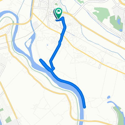
取手 鬼怒川 宇都宮
A cycling route starting in Fujishiro, Ibaraki, Japan.
Overview
About this route
- -:--
- Duration
- 44 km
- Distance
- 46 m
- Ascent
- 31 m
- Descent
- ---
- Avg. speed
- ---
- Max. altitude

Route quality
Waytypes & surfaces along the route
Waytypes
Cycleway
20.3 km
(46 %)
Quiet road
16.8 km
(38 %)
Surfaces
Paved
23.7 km
(54 %)
Paved (undefined)
22.4 km
(51 %)
Asphalt
1.3 km
(3 %)
Undefined
20.3 km
(46 %)
Continue with Bikemap
Use, edit, or download this cycling route
You would like to ride 取手 鬼怒川 宇都宮 or customize it for your own trip? Here is what you can do with this Bikemap route:
Free features
- Save this route as favorite or in collections
- Copy & plan your own version of this route
- Sync your route with Garmin or Wahoo
Premium features
Free trial for 3 days, or one-time payment. More about Bikemap Premium.
- Navigate this route on iOS & Android
- Export a GPX / KML file of this route
- Create your custom printout (try it for free)
- Download this route for offline navigation
Discover more Premium features.
Get Bikemap PremiumFrom our community
Other popular routes starting in Fujishiro
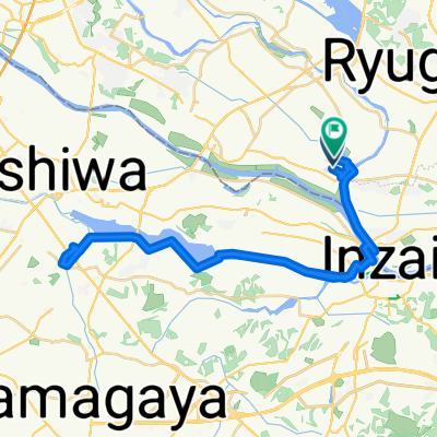
 De 26, Sanuki 3-Chōme, Ryugasaki à 98, Oshikiri, Toride
- Distance
- 4.4 km
- Ascent
- 4 m
- Descent
- 6 m
- Location
- Fujishiro, Ibaraki, Japan
 1丁目 まで1丁目
- Distance
- 9 km
- Ascent
- 10 m
- Descent
- 57 m
- Location
- Fujishiro, Ibaraki, Japan
 Recovered Route
- Distance
- 13.3 km
- Ascent
- 36 m
- Descent
- 33 m
- Location
- Fujishiro, Ibaraki, Japan
 取手 鬼怒川 宇都宮
- Distance
- 44 km
- Ascent
- 46 m
- Descent
- 31 m
- Location
- Fujishiro, Ibaraki, Japan
 一般県道取手水海道自転車道線(小貝川自転車道)
- Distance
- 30.9 km
- Ascent
- 99 m
- Descent
- 91 m
- Location
- Fujishiro, Ibaraki, Japan
 178, Fujishiro, Toride to 53, Oka, Toride
- Distance
- 7.2 km
- Ascent
- 14 m
- Descent
- 10 m
- Location
- Fujishiro, Ibaraki, Japan
 Steady ride
- Distance
- 47.6 km
- Ascent
- 120 m
- Descent
- 118 m
- Location
- Fujishiro, Ibaraki, Japan
Open it in the app