

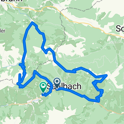
Schattberg-Ostgipfel-Westgipfel-Runde
A cycling route starting in Saalbach, Salzburg, Austria.
Overview
About this route
- -:--
- Duration
- 28.1 km
- Distance
- 1,178 m
- Ascent
- 1,181 m
- Descent
- ---
- Avg. speed
- ---
- Max. altitude
Continue with Bikemap
Use, edit, or download this cycling route
You would like to ride Schattberg-Ostgipfel-Westgipfel-Runde or customize it for your own trip? Here is what you can do with this Bikemap route:
Free features
- Save this route as favorite or in collections
- Copy & plan your own version of this route
- Sync your route with Garmin or Wahoo
Premium features
Free trial for 3 days, or one-time payment. More about Bikemap Premium.
- Navigate this route on iOS & Android
- Export a GPX / KML file of this route
- Create your custom printout (try it for free)
- Download this route for offline navigation
Discover more Premium features.
Get Bikemap PremiumFrom our community
Other popular routes starting in Saalbach
 Saalbach - Schattberg - Hinterglemm - Saalbach
- Distance
- 34.1 km
- Ascent
- 1,699 m
- Descent
- 1,469 m
- Location
- Saalbach, Salzburg, Austria
 Saalbach-Asitz-Leogang-Hochfilzen-Saalbach
- Distance
- 48.9 km
- Ascent
- 1,950 m
- Descent
- 1,945 m
- Location
- Saalbach, Salzburg, Austria
 Saalbach - Barenalm - Lindlingalm - Hinterglemm - Saalbach
- Distance
- 36 km
- Ascent
- 1,212 m
- Descent
- 1,214 m
- Location
- Saalbach, Salzburg, Austria
 Saalbach 2009 - Jausern, Schonleitenhutte, SpielbergHaus, BurgerAlm, ReiterKogel
- Distance
- 46.2 km
- Ascent
- 1,975 m
- Descent
- 1,903 m
- Location
- Saalbach, Salzburg, Austria
 Panoramaalm Saalbach Med 23
- Distance
- 19.1 km
- Ascent
- 657 m
- Descent
- 656 m
- Location
- Saalbach, Salzburg, Austria
 Tiroler Runde made by Ochsenteam
- Distance
- 41.2 km
- Ascent
- 1,305 m
- Descent
- 1,299 m
- Location
- Saalbach, Salzburg, Austria
 Saalbach - Spielbergalm - Schattberg - Saalbach
- Distance
- 37.9 km
- Ascent
- 1,768 m
- Descent
- 1,768 m
- Location
- Saalbach, Salzburg, Austria
 Schreiende Brunnen Tour Spielberghaus Ochsenteam on Tour
- Distance
- 27.8 km
- Ascent
- 1,078 m
- Descent
- 1,078 m
- Location
- Saalbach, Salzburg, Austria
Open it in the app