Limesweg RLK
- 22.9 km
- 311 m
- 314 m
- Oberbachheim, Rhineland-Palatinate, Germany
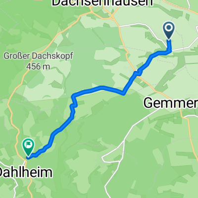
A cycling route starting in Oberbachheim, Rhineland-Palatinate, Germany.
Overview
Easy trekking or mountain bike loop from Oberbachheim over Spitzen Stein, past Winterwerb, Gemmerich, Himmighofen, and Kasdorf. Then through Bogel, over Endlichhofen to Miehlen. Here, enter opposite the community center, along the Mühlbach stream via Marienfels to Geisig, then continue to Dessighofen and back to Oberbachheim via Niederbachheim. The start and end point is the village community center.
created this 6 years ago
Continue with Bikemap
You would like to ride Taunushöhenweg - 1 or customize it for your own trip? Here is what you can do with this Bikemap route:
Free trial for 3 days, or one-time payment. More about Bikemap Premium.
Discover more Premium features.
Get Bikemap PremiumFrom our community
Open it in the app