

鋸山林道&風張林道
A cycling route starting in Ōme, Tokyo, Japan.
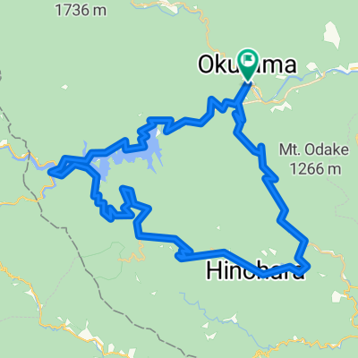
Overview
About this route
- -:--
- Duration
- 56.1 km
- Distance
- 1,487 m
- Ascent
- 1,488 m
- Descent
- ---
- Avg. speed
- ---
- Max. altitude

Continue with Bikemap
Use, edit, or download this cycling route
You would like to ride 鋸山林道&風張林道 or customize it for your own trip? Here is what you can do with this Bikemap route:
Free features
- Save this route as favorite or in collections
- Copy & plan your own version of this route
- Sync your route with Garmin or Wahoo
Premium features
Free trial for 3 days, or one-time payment. More about Bikemap Premium.
- Navigate this route on iOS & Android
- Export a GPX / KML file of this route
- Create your custom printout (try it for free)
- Download this route for offline navigation
Discover more Premium features.
Get Bikemap PremiumFrom our community
Other popular routes starting in Ōme
 日原鍾乳洞
日原鍾乳洞- Distance
- 66.1 km
- Ascent
- 697 m
- Descent
- 702 m
- Location
- Ōme, Tokyo, Japan
 Okutama to Noborito
- Distance
- 104.8 km
- Ascent
- 934 m
- Descent
- 1,248 m
- Location
- Ōme, Tokyo, Japan
 奥多摩ー柳沢ー笹子ー大月
- Distance
- 93.8 km
- Ascent
- 1,918 m
- Descent
- 1,895 m
- Location
- Ōme, Tokyo, Japan
 リハビリライド
- Distance
- 111.8 km
- Ascent
- 4,925 m
- Descent
- 4,760 m
- Location
- Ōme, Tokyo, Japan
 Day 608
- Distance
- 50.7 km
- Ascent
- 60 m
- Descent
- 225 m
- Location
- Ōme, Tokyo, Japan
 鋸山林道(奥多摩〜武蔵五日市)
- Distance
- 27.7 km
- Ascent
- 807 m
- Descent
- 964 m
- Location
- Ōme, Tokyo, Japan
 naguriko dirt
- Distance
- 39.8 km
- Ascent
- 908 m
- Descent
- 905 m
- Location
- Ōme, Tokyo, Japan
 鋸山林道&風張林道
- Distance
- 56.1 km
- Ascent
- 1,487 m
- Descent
- 1,488 m
- Location
- Ōme, Tokyo, Japan
Open it in the app