


0
- 6.9 km
- 168 m
- 173 m
- Bad Eisenkappel, Carinthia, Austria
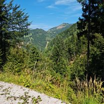
Slowenien Tour 2019
A cycling route starting in Bad Eisenkappel, Carinthia, Austria.
Overview
Bad Eisenkappel - Bleiburg - Dravograd - Radlje ob Dravi
created this 7 years ago
Part of
11 stages
Route quality
Road
34.1 km
44 %
Quiet road
11.6 km
15 %
Paved
50.4 km
(65 %)
Unpaved
5.4 km
(7 %)
Asphalt
44.2 km
57 %
Paved (undefined)
6.2 km
8 %
Continue with Bikemap
You would like to ride #Slowenien #4: Bad Eisenkappel - Radlje ob Dravi or customize it for your own trip? Here is what you can do with this Bikemap route:
Free trial for 3 days, or one-time payment. More about Bikemap Premium.
Discover more Premium features.
Get Bikemap PremiumFrom our community


Open it in the app