Castello Branko - Porto - 400 км
A cycling route starting in Castelo Branco, Castelo Branco, Portugal.
Overview
About this route
- -:--
- Duration
- 400.7 km
- Distance
- 2,719 m
- Ascent
- 2,956 m
- Descent
- ---
- Avg. speed
- ---
- Avg. speed
Route quality
Waytypes & surfaces along the route
Waytypes
Quiet road
113.3 km
(28 %)
Track
98.6 km
(25 %)
Surfaces
Paved
59.6 km
(15 %)
Unpaved
27.6 km
(7 %)
Asphalt
54.2 km
(14 %)
Unpaved (undefined)
14.6 km
(4 %)
Route highlights
Points of interest along the route
Point of interest after 22.9 km
Возможное место ночевки у реки
Point of interest after 41.2 km
Camping cmcd.pt Municipal Camping Park In Idanha-a-Nova
Point of interest after 58.7 km
Деревня Монсанту
Point of interest after 70.6 km
Живиписная деревушка в скалах и тропа с окаменелостями
Point of interest after 92.7 km
Кэмпинг Parque de Campismo do Freixial http://www.cm-penamacor.pt
Point of interest after 134.6 km
Древняя средневековая деревня Сортелья
Point of interest after 151.1 km
Башня сто клеток 1век Рим
Point of interest after 158.7 km
Пляж - Португальская Швейцария
Point of interest after 158.7 km
Кэмпинг Valhelhas https://valhelhascamping.com/en
Point of interest after 170.7 km
Возможное место стоянки
Point of interest after 174.6 km
Возможное место ночевки
Point of interest after 245.4 km
Самое большое дерево Португалии Эвкалипт
Point of interest after 249.9 km
Camping Camping "Quinta Chave Grande" http://www.chavegrande.com/index.php/en/precos
Point of interest after 279.5 km
Camping
Point of interest after 320.8 km
Место возможной ночевки по эту, либо по другую сторону реки притока
Point of interest after 321.2 km
Живописный канал
Point of interest after 321.9 km
Парк для отдыха, возможно с влдопроводом
Point of interest after 374.9 km
Camping
Continue with Bikemap
Use, edit, or download this cycling route
You would like to ride Castello Branko - Porto - 400 км or customize it for your own trip? Here is what you can do with this Bikemap route:
Free features
- Save this route as favorite or in collections
- Copy & plan your own version of this route
- Sync your route with Garmin or Wahoo
Premium features
Free trial for 3 days, or one-time payment. More about Bikemap Premium.
- Navigate this route on iOS & Android
- Export a GPX / KML file of this route
- Create your custom printout (try it for free)
- Download this route for offline navigation
Discover more Premium features.
Get Bikemap PremiumFrom our community
Other popular routes starting in Castelo Branco
- TP2022. Etapa 5.
- Distance
- 194.4 km
- Ascent
- 2,647 m
- Descent
- 2,757 m
- Location
- Castelo Branco, Castelo Branco, Portugal
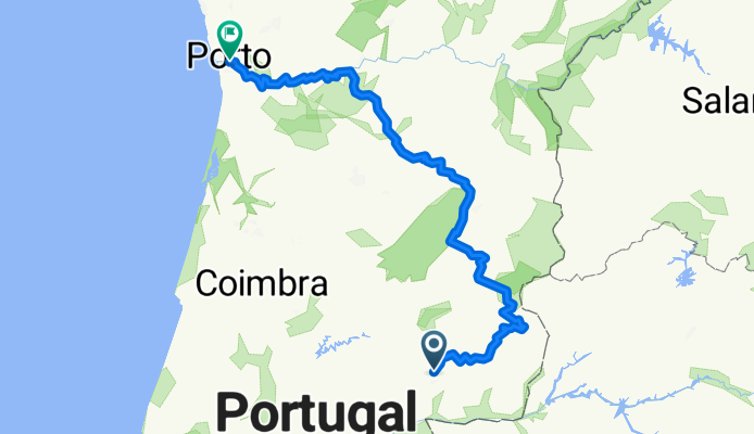
- Volta pela Foz Giraldo
- Distance
- 90.4 km
- Ascent
- 1,130 m
- Descent
- 1,130 m
- Location
- Castelo Branco, Castelo Branco, Portugal
- CB Vale Ursa CB
- Distance
- 129.1 km
- Ascent
- 1,795 m
- Descent
- 1,795 m
- Location
- Castelo Branco, Castelo Branco, Portugal
- Treino Básico CB_Alcains_Outros_CB - Treino Básico CB_Alcains_Outros_CB
- Distance
- 62.1 km
- Ascent
- 656 m
- Descent
- 654 m
- Location
- Castelo Branco, Castelo Branco, Portugal
- Benquerenças 35
- Distance
- 34.2 km
- Ascent
- 252 m
- Descent
- 254 m
- Location
- Castelo Branco, Castelo Branco, Portugal
- De Rua Cunha e Castro 7923, Castelo Branco a Rua José Castanheira 10, Castelo Branco
- Distance
- 12.6 km
- Ascent
- 91 m
- Descent
- 85 m
- Location
- Castelo Branco, Castelo Branco, Portugal
- CB - Segura - Rosmaninhal - Malpica - Lentiscais . Cebolais - CB
- Distance
- 149.5 km
- Ascent
- 1,011 m
- Descent
- 991 m
- Location
- Castelo Branco, Castelo Branco, Portugal
- Benquerenças 27
- Distance
- 26.4 km
- Ascent
- 276 m
- Descent
- 276 m
- Location
- Castelo Branco, Castelo Branco, Portugal
Open it in the app