
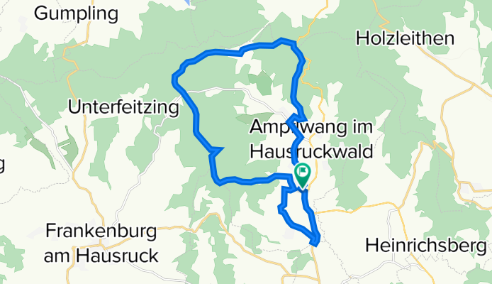
Scheiblwies-Rödleiten-Göblberg- Hinterschlagen
A cycling route starting in Redleiten, Upper Austria, Austria.
Overview
About this route
- -:--
- Duration
- 17.8 km
- Distance
- 383 m
- Ascent
- 380 m
- Descent
- ---
- Avg. speed
- ---
- Max. altitude
Route quality
Waytypes & surfaces along the route
Waytypes
Track
8.6 km
(48 %)
Quiet road
5.1 km
(29 %)
Surfaces
Paved
5.4 km
(30 %)
Unpaved
8.1 km
(45 %)
Gravel
6.7 km
(37 %)
Asphalt
5.4 km
(30 %)
Continue with Bikemap
Use, edit, or download this cycling route
You would like to ride Scheiblwies-Rödleiten-Göblberg- Hinterschlagen or customize it for your own trip? Here is what you can do with this Bikemap route:
Free features
- Save this route as favorite or in collections
- Copy & plan your own version of this route
- Sync your route with Garmin or Wahoo
Premium features
Free trial for 3 days, or one-time payment. More about Bikemap Premium.
- Navigate this route on iOS & Android
- Export a GPX / KML file of this route
- Create your custom printout (try it for free)
- Download this route for offline navigation
Discover more Premium features.
Get Bikemap PremiumFrom our community
Other popular routes starting in Redleiten
 Göblberg - Pettenfirsthütte
- Distance
- 13.4 km
- Ascent
- 265 m
- Descent
- 351 m
- Location
- Redleiten, Upper Austria, Austria
 Ampflwang Rundstrecke
- Distance
- 46.3 km
- Ascent
- 657 m
- Descent
- 660 m
- Location
- Redleiten, Upper Austria, Austria
 Frankenburg Umrundung
- Distance
- 39.5 km
- Ascent
- 659 m
- Descent
- 660 m
- Location
- Redleiten, Upper Austria, Austria
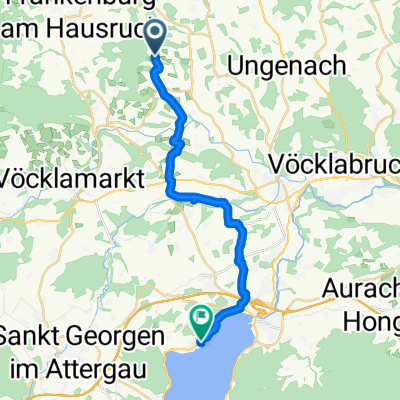 Neukirchen zum Attersee ( Litzlberg)
- Distance
- 18.5 km
- Ascent
- 214 m
- Descent
- 256 m
- Location
- Redleiten, Upper Austria, Austria
 Moderate Route in Frankenburg am Hausruck
- Distance
- 4.6 km
- Ascent
- 110 m
- Descent
- 104 m
- Location
- Redleiten, Upper Austria, Austria
 Göblberg Runde
- Distance
- 12.4 km
- Ascent
- 343 m
- Descent
- 340 m
- Location
- Redleiten, Upper Austria, Austria
 Zell Hausruck Göblberg innerleiten
- Distance
- 24.8 km
- Ascent
- 517 m
- Descent
- 506 m
- Location
- Redleiten, Upper Austria, Austria
 Göblberg - Pettenfirst - 30km
- Distance
- 29.8 km
- Ascent
- 595 m
- Descent
- 596 m
- Location
- Redleiten, Upper Austria, Austria
Open it in the app