

Caps' Ride
A cycling route starting in Three Legged Cross, England, United Kingdom.
Overview
About this route
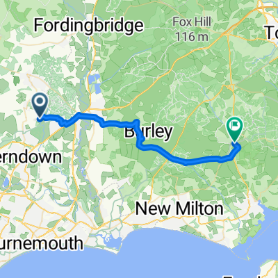
Moor Crichel - Shaftesbury-Tisbury-Wilton and home.
- -:--
- Duration
- 92.5 km
- Distance
- 587 m
- Ascent
- 587 m
- Descent
- ---
- Avg. speed
- ---
- Max. altitude

Route quality
Waytypes & surfaces along the route
Waytypes
Road
47 km
(51 %)
Quiet road
18.2 km
(20 %)
Surfaces
Paved
34 km
(37 %)
Unpaved
5 km
(5 %)
Asphalt
33.4 km
(36 %)
Gravel
4.1 km
(4 %)
Continue with Bikemap
Use, edit, or download this cycling route
You would like to ride Caps' Ride or customize it for your own trip? Here is what you can do with this Bikemap route:
Free features
- Save this route as favorite or in collections
- Copy & plan your own version of this route
- Split it into stages to create a multi-day tour
- Sync your route with Garmin or Wahoo
Premium features
Free trial for 3 days, or one-time payment. More about Bikemap Premium.
- Navigate this route on iOS & Android
- Export a GPX / KML file of this route
- Create your custom printout (try it for free)
- Download this route for offline navigation
Discover more Premium features.
Get Bikemap PremiumFrom our community
Other popular routes starting in Three Legged Cross
 Day11D
- Distance
- 35 km
- Ascent
- 225 m
- Descent
- 273 m
- Location
- Three Legged Cross, England, United Kingdom
 Caps' Ride
- Distance
- 92.5 km
- Ascent
- 587 m
- Descent
- 587 m
- Location
- Three Legged Cross, England, United Kingdom
 444 Ringwood Road, Wimborne to Castleman Trailway, Wimborne
- Distance
- 13.2 km
- Ascent
- 159 m
- Descent
- 151 m
- Location
- Three Legged Cross, England, United Kingdom
 Joys Road 65, Three Legged Cross to Fernside Avenue 35
- Distance
- 22 km
- Ascent
- 165 m
- Descent
- 180 m
- Location
- Three Legged Cross, England, United Kingdom
 Holly Tree Cottage, Ringwood Road, Wimborne to Holly Tree Cottage, Ringwood Road, Wimborne
- Distance
- 7.4 km
- Ascent
- 28 m
- Descent
- 29 m
- Location
- Three Legged Cross, England, United Kingdom
 Langs to Brockenhurst
- Distance
- 28.1 km
- Ascent
- 187 m
- Descent
- 183 m
- Location
- Three Legged Cross, England, United Kingdom
 Salisbury-Holt-using lanes40k
- Distance
- 40.4 km
- Ascent
- 374 m
- Descent
- 349 m
- Location
- Three Legged Cross, England, United Kingdom
 one stop and back
- Distance
- 4.8 km
- Ascent
- 24 m
- Descent
- 31 m
- Location
- Three Legged Cross, England, United Kingdom
Open it in the app