

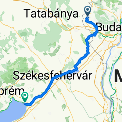
Zsámbéki tekergés
A cycling route starting in Zsámbék, Pest County, Hungary.
Overview
About this route
Zsámbék
Tájház
Védett gyurgyalagok
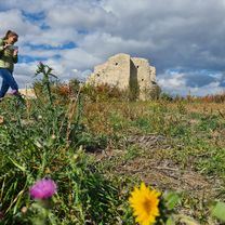
Kálvária
Pestiskápolna
Angyalárok
Trianon emlékpark
Zichy-kastély
Szent Ferenc-kút
Szabadságoszlop
Zsámbéki romtemplom
Légvédelmi múzeum
Királytölgy
Hanna pihenő
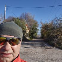
Kőbánya
Tűzoltó múzeum
Keresztelő Szent János születése templom
Török-fürdő
Zárdakert
Zichy-kastély
Melocco ivókútja
Pestis-emlékmi
Zsámbék
- -:--
- Duration
- 14.7 km
- Distance
- 234 m
- Ascent
- 232 m
- Descent
- ---
- Avg. speed
- ---
- Max. altitude

Route quality
Waytypes & surfaces along the route
Waytypes
Track
6.3 km
(43 %)
Quiet road
4.1 km
(28 %)
Surfaces
Paved
2.9 km
(20 %)
Unpaved
1.8 km
(12 %)
Asphalt
2.8 km
(19 %)
Unpaved (undefined)
0.9 km
(6 %)
Continue with Bikemap
Use, edit, or download this cycling route
You would like to ride Zsámbéki tekergés or customize it for your own trip? Here is what you can do with this Bikemap route:
Free features
- Save this route as favorite or in collections
- Copy & plan your own version of this route
- Sync your route with Garmin or Wahoo
Premium features
Free trial for 3 days, or one-time payment. More about Bikemap Premium.
- Navigate this route on iOS & Android
- Export a GPX / KML file of this route
- Create your custom printout (try it for free)
- Download this route for offline navigation
Discover more Premium features.
Get Bikemap PremiumFrom our community
Other popular routes starting in Zsámbék
 Zsámbék kör
- Distance
- 29.3 km
- Ascent
- 209 m
- Descent
- 209 m
- Location
- Zsámbék, Pest County, Hungary
 Rövidkör
- Distance
- 34.5 km
- Ascent
- 336 m
- Descent
- 390 m
- Location
- Zsámbék, Pest County, Hungary
 Zsámbék - Tök
- Distance
- 17.8 km
- Ascent
- 114 m
- Descent
- 155 m
- Location
- Zsámbék, Pest County, Hungary
 Széchenyi István utca, Tök - Bakony utca, Balatonakarattya
- Distance
- 111.5 km
- Ascent
- 855 m
- Descent
- 847 m
- Location
- Zsámbék, Pest County, Hungary
 Zsámbéki tekergés
- Distance
- 14.7 km
- Ascent
- 234 m
- Descent
- 232 m
- Location
- Zsámbék, Pest County, Hungary
 Zsámbék-Dobogókő-Zsámbék
- Distance
- 95.8 km
- Ascent
- 1,061 m
- Descent
- 1,060 m
- Location
- Zsámbék, Pest County, Hungary
 Petőfi Sándor utca, Zsámbék - Petőfi Sándor utca, Zsámbék
- Distance
- 12.8 km
- Ascent
- 110 m
- Descent
- 109 m
- Location
- Zsámbék, Pest County, Hungary
 Hegyalja út - Hegyalja út
- Distance
- 15.4 km
- Ascent
- 82 m
- Descent
- 131 m
- Location
- Zsámbék, Pest County, Hungary
Open it in the app