

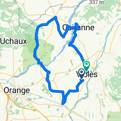
violes - aix
A cycling route starting in Violès, Provence-Alpes-Côte d'Azur Region, France.
Overview
About this route
- -:--
- Duration
- 276.2 km
- Distance
- 2,658 m
- Ascent
- 2,506 m
- Descent
- ---
- Avg. speed
- ---
- Max. altitude

Route quality
Waytypes & surfaces along the route
Waytypes
Road
47 km
(17 %)
Quiet road
44.2 km
(16 %)
Surfaces
Paved
168.5 km
(61 %)
Unpaved
8.3 km
(3 %)
Asphalt
168.5 km
(61 %)
Gravel
5.5 km
(2 %)
Continue with Bikemap
Use, edit, or download this cycling route
You would like to ride violes - aix or customize it for your own trip? Here is what you can do with this Bikemap route:
Free features
- Save this route as favorite or in collections
- Copy & plan your own version of this route
- Split it into stages to create a multi-day tour
- Sync your route with Garmin or Wahoo
Premium features
Free trial for 3 days, or one-time payment. More about Bikemap Premium.
- Navigate this route on iOS & Android
- Export a GPX / KML file of this route
- Create your custom printout (try it for free)
- Download this route for offline navigation
Discover more Premium features.
Get Bikemap PremiumFrom our community
Other popular routes starting in Violès
 violes - aix
- Distance
- 276.2 km
- Ascent
- 2,658 m
- Descent
- 2,506 m
- Location
- Violès, Provence-Alpes-Côte d'Azur Region, France
 De Chemin des Cyprès, Violès à 1 Rue de la Cavalerie, Arles
- Distance
- 94.1 km
- Ascent
- 117 m
- Descent
- 200 m
- Location
- Violès, Provence-Alpes-Côte d'Azur Region, France
 07 2021 et2
- Distance
- 259.1 km
- Ascent
- 2,046 m
- Descent
- 2,131 m
- Location
- Violès, Provence-Alpes-Côte d'Azur Region, France
 Route in Violès 45km
- Distance
- 45.4 km
- Ascent
- 212 m
- Descent
- 202 m
- Location
- Violès, Provence-Alpes-Côte d'Azur Region, France
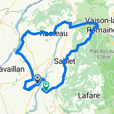 Violès bis Vaison 56km
- Distance
- 56.7 km
- Ascent
- 856 m
- Descent
- 837 m
- Location
- Violès, Provence-Alpes-Côte d'Azur Region, France
 Violes - Les Flôrets
- Distance
- 5.4 km
- Ascent
- 213 m
- Descent
- 4 m
- Location
- Violès, Provence-Alpes-Côte d'Azur Region, France
 départ pluie perte du portable
- Distance
- 84.5 km
- Ascent
- 1,057 m
- Descent
- 464 m
- Location
- Violès, Provence-Alpes-Côte d'Azur Region, France
 Jonquières naar 40D Chemin Camp Reboul, Jonquières
- Distance
- 6.2 km
- Ascent
- 19 m
- Descent
- 34 m
- Location
- Violès, Provence-Alpes-Côte d'Azur Region, France
Open it in the app