

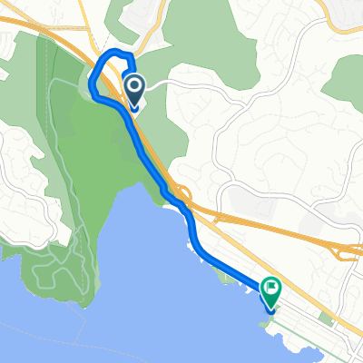
bridge to bridge Benicia State Park
A cycling route starting in Crockett, California, United States.
Overview
About this route
- 2 h 37 min
- Duration
- 40.3 km
- Distance
- 516 m
- Ascent
- 515 m
- Descent
- 15.4 km/h
- Avg. speed
- ---
- Max. altitude

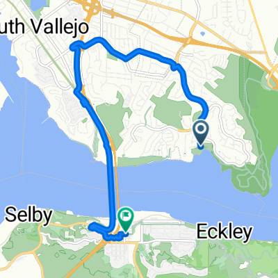
Route photos


Route quality
Waytypes & surfaces along the route
Waytypes
Quiet road
12.1 km
(30 %)
Road
8.9 km
(22 %)
Surfaces
Paved
3.4 km
(8 %)
Asphalt
2.5 km
(6 %)
Concrete
0.7 km
(2 %)
Continue with Bikemap
Use, edit, or download this cycling route
You would like to ride bridge to bridge Benicia State Park or customize it for your own trip? Here is what you can do with this Bikemap route:
Free features
- Save this route as favorite or in collections
- Copy & plan your own version of this route
- Sync your route with Garmin or Wahoo
Premium features
Free trial for 3 days, or one-time payment. More about Bikemap Premium.
- Navigate this route on iOS & Android
- Export a GPX / KML file of this route
- Create your custom printout (try it for free)
- Download this route for offline navigation
Discover more Premium features.
Get Bikemap PremiumFrom our community
Other popular routes starting in Crockett
 Route from I-780 W, Benicia
- Distance
- 4 km
- Ascent
- 17 m
- Descent
- 26 m
- Location
- Crockett, California, United States
 Route to 1700 Nevin Ave, Richmond
- Distance
- 23.7 km
- Ascent
- 220 m
- Descent
- 230 m
- Location
- Crockett, California, United States
 Bailey St, Vallejo to 1212 Wanda St, Crockett
- Distance
- 9.4 km
- Ascent
- 0 m
- Descent
- 7 m
- Location
- Crockett, California, United States
 Martinez Loop
- Distance
- 38 km
- Ascent
- 334 m
- Descent
- 345 m
- Location
- Crockett, California, United States
 Greenmont Drive 1101, Vallejo to Greenmont Drive 1031, Vallejo
- Distance
- 77.4 km
- Ascent
- 1,032 m
- Descent
- 1,032 m
- Location
- Crockett, California, United States
 McEwen Rd
- Distance
- 0.9 km
- Ascent
- 106 m
- Descent
- 0 m
- Location
- Crockett, California, United States
 Glen Cove Loop
- Distance
- 8.6 km
- Ascent
- 144 m
- Descent
- 142 m
- Location
- Crockett, California, United States
 bridge to bridge Benicia State Park
- Distance
- 40.3 km
- Ascent
- 516 m
- Descent
- 515 m
- Location
- Crockett, California, United States
Open it in the app