Murcia_Caravaca Camino Jubilar 2010 Mota del río Segura+Vía del Tren+Vía Verde del Noroeste
A cycling route starting in Murcia, Murcia, Spain.
Overview
About this route
- -:--
- Duration
- 90.5 km
- Distance
- 766 m
- Ascent
- 170 m
- Descent
- ---
- Avg. speed
- ---
- Max. altitude
Route quality
Waytypes & surfaces along the route
Waytypes
Cycleway
32.6 km
(36 %)
Track
25.3 km
(28 %)
Surfaces
Paved
27.1 km
(30 %)
Unpaved
39.8 km
(44 %)
Gravel
35.3 km
(39 %)
Asphalt
23.5 km
(26 %)
Route highlights
Points of interest along the route

Point of interest after 4.3 km
Amanecer en la ruta Mota del Río Segura

Point of interest after 10.2 km
Mota del Río Segura, tramo acondicionado de Carril Bici hasta la Contraparada
Point of interest after 12.6 km
Cambiarse de margen del río, a traves de un puente peatonal con escalera metálica, justo al pasar por debajo de la autovía de Andalucía

Point of interest after 19.7 km
Rio Mula, entre el término de Las Torres de Cotillas y Alguazas, en dirección a la Torre Vieja

Point of interest after 20.9 km
Vista de la Torre Vieja

Point of interest after 23.2 km
Iglesia de Alguazas
Point of interest after 23.7 km
Rotonda hacia Las Torres de Cotillas
Point of interest after 23.7 km
Observar una señal que indica "CLUB HIPICO" y a la derecha una pegatina del Jubileo a Caravaca
Point of interest after 23.8 km
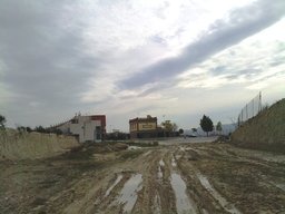
Camino de tierra

Point of interest after 32 km
Estación de Los Rodeos

Point of interest after 35.3 km
Estación de Campos del Río
Point of interest after 37.6 km
En la última rotonda de la carretera, no tomar hacia Albudite, desviaros a la derecha que va directa por la Vía del Tren hacia la Estación de Albudeite

Point of interest after 39.4 km
Estación de Albudite

Point of interest after 41.5 km
Puente sobre el río Mula, el tramo está en malas condiciones con socavones tremendas por las aguas torrenciales.

Point of interest after 42.5 km
Estación de Los Baños de Mula

Point of interest after 42.6 km
Inicio del tramo de Vía Verde del Noroeste Los Baños de Mula hasta Caravaca

Point of interest after 45.6 km
Estacion de La Puebla de Mula
Point of interest after 47.9 km
Mejor tomar la carretera C-415a hacia Bullas, Cehegín y Caravaca que seguir las indicaciones de la Vía Verde, está mal pavimentada y da un rodeo fatal.
Point of interest after 52.7 km
Inicio de la Vía Verde, desde El Niño de Mula hasta Bullas.

Point of interest after 52.8 km
Estacion El Niño de Mula
Point of interest after 52.9 km
Restaurantes de El Niño de Mula
Point of interest after 53 km
Santuario de El Niño de Mula

Point of interest after 53.2 km
Primer tunel, corto y no iluminado.
Point of interest after 53.7 km
Segundo tunel sin iluminación
Point of interest after 56.4 km
Tunel iluminado (cuidado, se ve fatal)

Point of interest after 57.6 km
Estación de La Luz

Point of interest after 70.4 km
Campo de placas solares
Point of interest after 70.5 km
EDAR de Bullas, depuradora de aguas residuales.
Point of interest after 71.4 km
Se retoma la Vía Verde desde Bullas a Caravaca

Point of interest after 72.9 km
Via Verde

Point of interest after 80.2 km
Puente sobre el río Quípar, cerca de Cehegín
Point of interest after 80.2 km

Point of interest after 82 km
Estación de Cehegín

Point of interest after 83.6 km
Inicio de la Vía Verde Cehegín-Caravaca, al lado Estación de Autobuses
Point of interest after 83.6 km
Point of interest after 83.6 km
Point of interest after 83.6 km
Point of interest after 90.5 km
Point of interest after 90.5 km
Point of interest after 90.5 km

Point of interest after 90.5 km
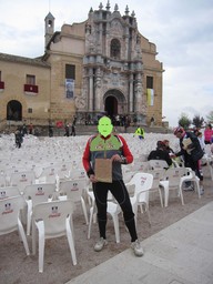
Santuario-Basílica de la Vera Cruz de Caravaca
Continue with Bikemap
Use, edit, or download this cycling route
You would like to ride Murcia_Caravaca Camino Jubilar 2010 Mota del río Segura+Vía del Tren+Vía Verde del Noroeste or customize it for your own trip? Here is what you can do with this Bikemap route:
Free features
- Save this route as favorite or in collections
- Copy & plan your own version of this route
- Split it into stages to create a multi-day tour
- Sync your route with Garmin or Wahoo
Premium features
Free trial for 3 days, or one-time payment. More about Bikemap Premium.
- Navigate this route on iOS & Android
- Export a GPX / KML file of this route
- Create your custom printout (try it for free)
- Download this route for offline navigation
Discover more Premium features.
Get Bikemap PremiumFrom our community
Other popular routes starting in Murcia
 Relojero - Puerto de la Cadena
- Distance
- 46.1 km
- Ascent
- 755 m
- Descent
- 757 m
- Location
- Murcia, Murcia, Spain
 MURCIA - CIEZA - FUENTE CAPUTA
- Distance
- 119 km
- Ascent
- 625 m
- Descent
- 625 m
- Location
- Murcia, Murcia, Spain
 santuario Fuensanta
- Distance
- 10.4 km
- Ascent
- 436 m
- Descent
- 338 m
- Location
- Murcia, Murcia, Spain
 Murcia_Caravaca Camino Jubilar 2010 Mota del río Segura+Vía del Tren+Vía Verde del Noroeste
- Distance
- 90.5 km
- Ascent
- 766 m
- Descent
- 170 m
- Location
- Murcia, Murcia, Spain
 Nº1 Via Verde Murcia Mula y vuelta Titoabuelito
- Distance
- 86 km
- Ascent
- 409 m
- Descent
- 411 m
- Location
- Murcia, Murcia, Spain
 143k. Archena, Garapacha, Hondon (5h , 1.575m)
- Distance
- 142.8 km
- Ascent
- 1,043 m
- Descent
- 1,050 m
- Location
- Murcia, Murcia, Spain
 ARRIXACA 8 Alea iacta est MURCIA HUERTA LIBRILLA COLA BARQUEROS CALDERONES PLIEGO1 PLIEGO2 GEBAS C.MARQUES LA PERDIZ CRUCE GEBAS F.LIBRILLA BARQUEROS HUERTA MUR
- Distance
- 136.9 km
- Ascent
- 1,263 m
- Descent
- 1,265 m
- Location
- Murcia, Murcia, Spain
 fuen Santa
- Distance
- 19.8 km
- Ascent
- 660 m
- Descent
- 708 m
- Location
- Murcia, Murcia, Spain
Open it in the app


