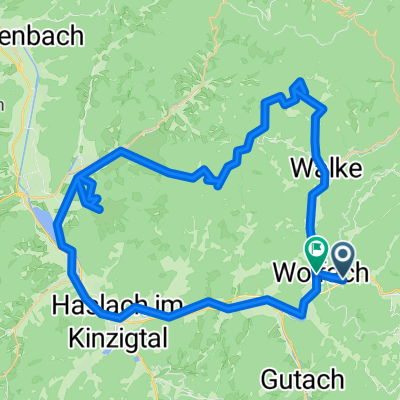

Wolfach - Kloster Wittichen - Schiltach
- 42.2 km
- 664 m
- 666 m
- Wolfach, Baden-Wurttemberg, Germany
A cycling route starting in Wolfach, Baden-Wurttemberg, Germany.
Overview
created this 6 years ago
Route quality
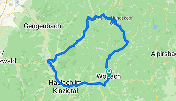
Path
13.9 km
(20 %)
Track
10.4 km
(15 %)
Paved
52 km
(75 %)
Unpaved
8.3 km
(12 %)
Asphalt
51.4 km
(74 %)
Gravel
6.2 km
(9 %)
Continue with Bikemap
You would like to ride Wolfach - Biberach - Bad Peterstal - Wolfach or customize it for your own trip? Here is what you can do with this Bikemap route:
Free trial for 3 days, or one-time payment. More about Bikemap Premium.
Discover more Premium features.
Get Bikemap PremiumFrom our community
Open it in the app