

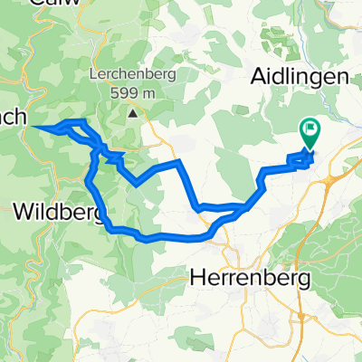
Renningen Wenninger Höfe 45 KM
A cycling route starting in Gärtringen, Baden-Wurttemberg, Germany.
Overview
About this route
- -:--
- Duration
- 44.6 km
- Distance
- 284 m
- Ascent
- 284 m
- Descent
- ---
- Avg. speed
- ---
- Max. altitude

Route quality
Waytypes & surfaces along the route
Waytypes
Track
20.1 km
(45 %)
Road
8.5 km
(19 %)
Surfaces
Paved
39.7 km
(89 %)
Unpaved
3.6 km
(8 %)
Asphalt
37.9 km
(85 %)
Paved (undefined)
1.8 km
(4 %)
Continue with Bikemap
Use, edit, or download this cycling route
You would like to ride Renningen Wenninger Höfe 45 KM or customize it for your own trip? Here is what you can do with this Bikemap route:
Free features
- Save this route as favorite or in collections
- Copy & plan your own version of this route
- Sync your route with Garmin or Wahoo
Premium features
Free trial for 3 days, or one-time payment. More about Bikemap Premium.
- Navigate this route on iOS & Android
- Export a GPX / KML file of this route
- Create your custom printout (try it for free)
- Download this route for offline navigation
Discover more Premium features.
Get Bikemap PremiumFrom our community
Other popular routes starting in Gärtringen
 Gärtringen Krabbanescht in Holzbronn
- Distance
- 36.6 km
- Ascent
- 424 m
- Descent
- 422 m
- Location
- Gärtringen, Baden-Wurttemberg, Germany
 Gärtringen - Deckenpfronn - Rohrau - Aidlingen
- Distance
- 43.2 km
- Ascent
- 349 m
- Descent
- 348 m
- Location
- Gärtringen, Baden-Wurttemberg, Germany
 Gärtringen - Sulz am Eck - Altdorf
- Distance
- 56.9 km
- Ascent
- 650 m
- Descent
- 668 m
- Location
- Gärtringen, Baden-Wurttemberg, Germany
 zum Einstimmen in die Saison
- Distance
- 39.4 km
- Ascent
- 338 m
- Descent
- 337 m
- Location
- Gärtringen, Baden-Wurttemberg, Germany
 Gärtringen - Oberjesingen - Schönbuch
- Distance
- 26.7 km
- Ascent
- 189 m
- Descent
- 190 m
- Location
- Gärtringen, Baden-Wurttemberg, Germany
 32km
32km- Distance
- 32.6 km
- Ascent
- 172 m
- Descent
- 171 m
- Location
- Gärtringen, Baden-Wurttemberg, Germany
 Gärtringen Neuenbürg und zurück
- Distance
- 110.2 km
- Ascent
- 1,811 m
- Descent
- 1,781 m
- Location
- Gärtringen, Baden-Wurttemberg, Germany
 Gärtringen, Aidlingen, Dachtel
- Distance
- 16.2 km
- Ascent
- 406 m
- Descent
- 364 m
- Location
- Gärtringen, Baden-Wurttemberg, Germany
Open it in the app