

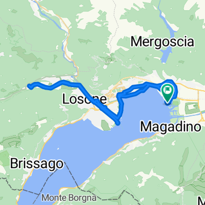
#4 Gambarogno-Alpe di Neggia
A cycling route starting in Magadino, Canton Ticino, Switzerland.
Overview
About this route
With Downhill
- -:--
- Duration
- 25.3 km
- Distance
- 1,261 m
- Ascent
- 1,261 m
- Descent
- ---
- Avg. speed
- ---
- Max. altitude

Continue with Bikemap
Use, edit, or download this cycling route
You would like to ride #4 Gambarogno-Alpe di Neggia or customize it for your own trip? Here is what you can do with this Bikemap route:
Free features
- Save this route as favorite or in collections
- Copy & plan your own version of this route
- Sync your route with Garmin or Wahoo
Premium features
Free trial for 3 days, or one-time payment. More about Bikemap Premium.
- Navigate this route on iOS & Android
- Export a GPX / KML file of this route
- Create your custom printout (try it for free)
- Download this route for offline navigation
Discover more Premium features.
Get Bikemap PremiumFrom our community
Other popular routes starting in Magadino
 Magadino Ebene 61km
- Distance
- 61 km
- Ascent
- 762 m
- Descent
- 759 m
- Location
- Magadino, Canton Ticino, Switzerland
 Passo Neggia
- Distance
- 56.9 km
- Ascent
- 3,100 m
- Descent
- 2,880 m
- Location
- Magadino, Canton Ticino, Switzerland
 Runde Rivera-Tamaro-Arosio
- Distance
- 44 km
- Ascent
- 1,582 m
- Descent
- 1,583 m
- Location
- Magadino, Canton Ticino, Switzerland
 Via Cantonale 141, Magadino nach Via Muraccio 6, Ascona
- Distance
- 16.7 km
- Ascent
- 110 m
- Descent
- 106 m
- Location
- Magadino, Canton Ticino, Switzerland
 #4 Gambarogno-Alpe di Neggia
- Distance
- 25.3 km
- Ascent
- 1,261 m
- Descent
- 1,261 m
- Location
- Magadino, Canton Ticino, Switzerland
 Via Lido
- Distance
- 41.3 km
- Ascent
- 142 m
- Descent
- 139 m
- Location
- Magadino, Canton Ticino, Switzerland
 Monte Tamaro Panorama
- Distance
- 31.6 km
- Ascent
- 756 m
- Descent
- 1,810 m
- Location
- Magadino, Canton Ticino, Switzerland
 Lago Runde
- Distance
- 167.7 km
- Ascent
- 1,873 m
- Descent
- 1,873 m
- Location
- Magadino, Canton Ticino, Switzerland
Open it in the app