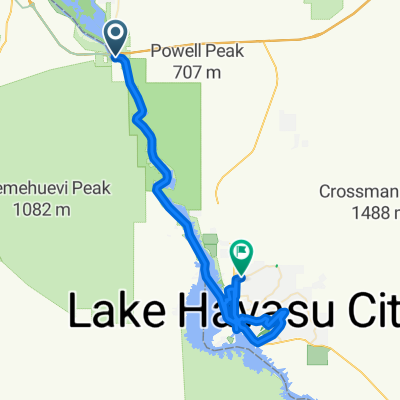
day 7 to Kingman AZ
A cycling route starting in Needles, California, United States of America.
Overview
About this route
- -:--
- Duration
- 84.1 km
- Distance
- 1,310 m
- Ascent
- 437 m
- Descent
- ---
- Avg. speed
- ---
- Avg. speed
Route quality
Waytypes & surfaces along the route
Waytypes
Busy road
64.3 km
(76 %)
Track
9.3 km
(11 %)
Surfaces
Paved
16.6 km
(20 %)
Unpaved
3.5 km
(4 %)
Asphalt
16.3 km
(19 %)
Gravel
3.5 km
(4 %)
Continue with Bikemap
Use, edit, or download this cycling route
You would like to ride day 7 to Kingman AZ or customize it for your own trip? Here is what you can do with this Bikemap route:
Free features
- Save this route as favorite or in collections
- Copy & plan your own version of this route
- Sync your route with Garmin or Wahoo
Premium features
Free trial for 3 days, or one-time payment. More about Bikemap Premium.
- Navigate this route on iOS & Android
- Export a GPX / KML file of this route
- Create your custom printout (try it for free)
- Download this route for offline navigation
Discover more Premium features.
Get Bikemap PremiumFrom our community
Other popular routes starting in Needles
- US Route E3: Mojave National Reserve - Seligman
- Distance
- 200.7 km
- Ascent
- 2,255 m
- Descent
- 815 m
- Location
- Needles, California, United States of America
- Needles Cycling
- Distance
- 83.8 km
- Ascent
- 1,351 m
- Descent
- 477 m
- Location
- Needles, California, United States of America
- Needles-Ludlow
- Distance
- 172.6 km
- Ascent
- 1,122 m
- Descent
- 743 m
- Location
- Needles, California, United States of America
- day 7 to Kingman AZ
- Distance
- 84.1 km
- Ascent
- 1,310 m
- Descent
- 437 m
- Location
- Needles, California, United States of America
- 66 (California)
- Distance
- 15.6 km
- Ascent
- 51 m
- Descent
- 95 m
- Location
- Needles, California, United States of America
- 66 (California)
- Distance
- 77.7 km
- Ascent
- 509 m
- Descent
- 371 m
- Location
- Needles, California, United States of America
- 20161030 ACA Route66 Westbound Needles CA - Danby CA #acaE6C2_2016
- Distance
- 89 km
- Ascent
- 655 m
- Descent
- 340 m
- Location
- Needles, California, United States of America
- Tag 31 Route66
- Distance
- 249.1 km
- Ascent
- 1,762 m
- Descent
- 1,261 m
- Location
- Needles, California, United States of America
Open it in the app