

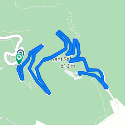
ALTO DE SANT SALVADOR DE FELANITX (por Felanitx)
A cycling route starting in Felanitx, Balearic Islands, Spain.
Overview
About this route
- -:--
- Duration
- 5.2 km
- Distance
- 369 m
- Ascent
- 46 m
- Descent
- ---
- Avg. speed
- ---
- Max. altitude

Route quality
Waytypes & surfaces along the route
Waytypes
Road
5.1 km
(99 %)
Quiet road
0.1 km
(1 %)
Surfaces
Paved
5.2 km
(100 %)
Asphalt
5.2 km
(100 %)
Continue with Bikemap
Use, edit, or download this cycling route
You would like to ride ALTO DE SANT SALVADOR DE FELANITX (por Felanitx) or customize it for your own trip? Here is what you can do with this Bikemap route:
Free features
- Save this route as favorite or in collections
- Copy & plan your own version of this route
- Sync your route with Garmin or Wahoo
Premium features
Free trial for 3 days, or one-time payment. More about Bikemap Premium.
- Navigate this route on iOS & Android
- Export a GPX / KML file of this route
- Create your custom printout (try it for free)
- Download this route for offline navigation
Discover more Premium features.
Get Bikemap PremiumFrom our community
Other popular routes starting in Felanitx
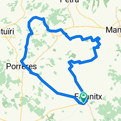
 Fin-SanSal-Santu-Fin
- Distance
- 38.2 km
- Ascent
- 661 m
- Descent
- 660 m
- Location
- Felanitx, Balearic Islands, Spain
 Felanitx - Pollença, Coll de Femenia - Lluc- Coll de Sa Batalla - Felanitx
- Distance
- 129.5 km
- Ascent
- 789 m
- Descent
- 806 m
- Location
- Felanitx, Balearic Islands, Spain
 San Salvador - Eremita Bonany
- Distance
- 71.8 km
- Ascent
- 809 m
- Descent
- 805 m
- Location
- Felanitx, Balearic Islands, Spain
 SANT SALVADOR, por Felanitx
- Distance
- 5.1 km
- Ascent
- 358 m
- Descent
- 37 m
- Location
- Felanitx, Balearic Islands, Spain
 Ma-4011, Felanitx a Ma-4011, Felanitx
- Distance
- 4.5 km
- Ascent
- 394 m
- Descent
- 267 m
- Location
- Felanitx, Balearic Islands, Spain
 felanitx 50k
- Distance
- 53.3 km
- Ascent
- 213 m
- Descent
- 213 m
- Location
- Felanitx, Balearic Islands, Spain
 Porrerez
- Distance
- 34.8 km
- Ascent
- 137 m
- Descent
- 138 m
- Location
- Felanitx, Balearic Islands, Spain
 MTB Son Macia
- Distance
- 18 km
- Ascent
- 245 m
- Descent
- 243 m
- Location
- Felanitx, Balearic Islands, Spain
Open it in the app