

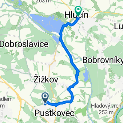
Bělský okruh - 25.5.2019
A cycling route starting in Hlučín, Moravskoslezský kraj, Czechia.
Overview
About this route
Středně náročná trasa s převýšením do 70 m. Určeno pro horská a crossová kola. Nářadí na opravu a láhev s vodu sebou. Terén: 70 % lesní cesty, 30% zpevněná cesta (asfalt, ámen) Na trase jsou pěkné výhledy, naučná stezka mezi Borovou a Chuchelnou, ale také hospůdky (Bělá, Borová a Chuchelná - cukrárna).
- -:--
- Duration
- 35.6 km
- Distance
- 301 m
- Ascent
- 301 m
- Descent
- ---
- Avg. speed
- ---
- Max. altitude

Continue with Bikemap
Use, edit, or download this cycling route
You would like to ride Bělský okruh - 25.5.2019 or customize it for your own trip? Here is what you can do with this Bikemap route:
Free features
- Save this route as favorite or in collections
- Copy & plan your own version of this route
- Sync your route with Garmin or Wahoo
Premium features
Free trial for 3 days, or one-time payment. More about Bikemap Premium.
- Navigate this route on iOS & Android
- Export a GPX / KML file of this route
- Create your custom printout (try it for free)
- Download this route for offline navigation
Discover more Premium features.
Get Bikemap PremiumFrom our community
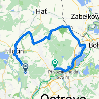
Other popular routes starting in Hlučín
 10.2 2011
- Distance
- 58.5 km
- Ascent
- 444 m
- Descent
- 445 m
- Location
- Hlučín, Moravskoslezský kraj, Czechia
 Okolo Ostravy 21.4.2016
- Distance
- 21.5 km
- Ascent
- 106 m
- Descent
- 109 m
- Location
- Hlučín, Moravskoslezský kraj, Czechia
 2.4 2011
- Distance
- 81.1 km
- Ascent
- 221 m
- Descent
- 221 m
- Location
- Hlučín, Moravskoslezský kraj, Czechia
 Oty Synka do Hrnčířská
- Distance
- 9.6 km
- Ascent
- 55 m
- Descent
- 93 m
- Location
- Hlučín, Moravskoslezský kraj, Czechia
 Oderské vrchy a Nízký Jeseník
- Distance
- 130.6 km
- Ascent
- 1,200 m
- Descent
- 1,200 m
- Location
- Hlučín, Moravskoslezský kraj, Czechia
 trasa 1
- Distance
- 28.7 km
- Ascent
- 213 m
- Descent
- 283 m
- Location
- Hlučín, Moravskoslezský kraj, Czechia
 Nedělní Projížďka.
- Distance
- 32 km
- Ascent
- 197 m
- Descent
- 196 m
- Location
- Hlučín, Moravskoslezský kraj, Czechia
 Porubajk 2014 68km
- Distance
- 63.2 km
- Ascent
- 818 m
- Descent
- 816 m
- Location
- Hlučín, Moravskoslezský kraj, Czechia
Open it in the app