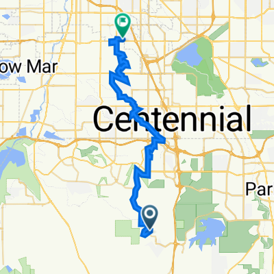
Foxfield - Hess Loop
A cycling route starting in Castle Pines North, Colorado, United States of America.
Overview
About this route
Park at 24Hr. Fitness at Parker and Arapahoe Rd. Follow the bike path south to Hess Rd. Head west on Hess Rd., (good shoulder on Hess) and climb the 4ish mile hill to South Havana Rd. Head north on S. Havana to Ridgegate, be careful of traffic. Head east for a short distance to Peoria and turn north. Stay on Peoria to the bike path at E-470. Head east on the E-470 bike path to the Cherry Creek trail. Head north on the Cherry Creek Trail to the starting point at .Parker and Arapahoe Rd
- -:--
- Duration
- 41.3 km
- Distance
- 272 m
- Ascent
- 274 m
- Descent
- ---
- Avg. speed
- ---
- Avg. speed
Route quality
Waytypes & surfaces along the route
Waytypes
Road
14.3 km
(35 %)
Busy road
10.7 km
(26 %)
Surfaces
Paved
30.7 km
(74 %)
Concrete
15.8 km
(38 %)
Asphalt
9 km
(22 %)
Continue with Bikemap
Use, edit, or download this cycling route
You would like to ride Foxfield - Hess Loop or customize it for your own trip? Here is what you can do with this Bikemap route:
Free features
- Save this route as favorite or in collections
- Copy & plan your own version of this route
- Sync your route with Garmin or Wahoo
Premium features
Free trial for 3 days, or one-time payment. More about Bikemap Premium.
- Navigate this route on iOS & Android
- Export a GPX / KML file of this route
- Create your custom printout (try it for free)
- Download this route for offline navigation
Discover more Premium features.
Get Bikemap PremiumFrom our community
Other popular routes starting in Castle Pines North
- north east-west loop
- Distance
- 23.3 km
- Ascent
- 393 m
- Descent
- 396 m
- Location
- Castle Pines North, Colorado, United States of America
- bike tour from Pastviny to Kistler Park
- Distance
- 18.3 km
- Ascent
- 27 m
- Descent
- 343 m
- Location
- Castle Pines North, Colorado, United States of America
- 7130 Medalist Ct, Castle Pines to Sedalia
- Distance
- 10.5 km
- Ascent
- 217 m
- Descent
- 191 m
- Location
- Castle Pines North, Colorado, United States of America
- South Havana Street, Castle Rock to South Havana Street, Castle Rock
- Distance
- 63.2 km
- Ascent
- 1,225 m
- Descent
- 1,225 m
- Location
- Castle Pines North, Colorado, United States of America
- 7141 Hyland Hills St, Castle Pines to 7130 Medalist Ct, Castle Pines
- Distance
- 12.9 km
- Ascent
- 160 m
- Descent
- 160 m
- Location
- Castle Pines North, Colorado, United States of America
- 1153 Berganot Trail, Castle Pines to Spring Gulch Trail, Highlands Ranch
- Distance
- 17.9 km
- Ascent
- 111 m
- Descent
- 372 m
- Location
- Castle Pines North, Colorado, United States of America
- 5 mile loop
- Distance
- 8 km
- Ascent
- 112 m
- Descent
- 110 m
- Location
- Castle Pines North, Colorado, United States of America
- Foxfield - Hess Loop
- Distance
- 41.3 km
- Ascent
- 272 m
- Descent
- 274 m
- Location
- Castle Pines North, Colorado, United States of America
Open it in the app