


Connecticut
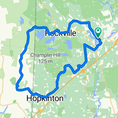
A cycling route starting in Hope Valley, Rhode Island, United States.
Overview
About this route
1
- -:--
- Duration
- 242.8 km
- Distance
- 1,166 m
- Ascent
- 1,058 m
- Descent
- ---
- Avg. speed
- ---
- Max. altitude
biga6000
created this 16 years ago
Route highlights
Points of interest along the route
Accommodation after 7.3 km
Puachaug State Forest
Point of interest after 59.4 km
Airline State Park Trail - South Trail End Points: East Hampton to Windham Counties: Hartford, Middlesex, New London, Windham Trail Length: 22.4 miles Trail Category: Rail-Trail Trail Surfaces: Asphalt, Crushed Stone
Point of interest after 88.1 km
Airline State Park Trail - South Trail End Points: East Hampton to Windham Counties: Hartford, Middlesex, New London, Windham Trail Length: 22.4 miles Trail Category: Rail-Trail Trail Surfaces: Asphalt, Crushed Stone
Photo after 127.9 km
Elizabith Park Rose Garden
Point of interest after 136.6 km
Farmington Canal Heritage Trail Trail End Points: New Haven to MA/CT Border Counties: Hartford, New Haven Trail Length: 40 miles Trail Category: Rail-Trail Trail Surfaces: Asphalt, Crushed Stone
Point of interest after 145.4 km
Anytime Fitness West Hartford, CT (860) 812-4311 340 N. Main St. West Hartford, CT 06117
Point of interest after 159.4 km
Farmington Canal Heritage Trail Trail End Points: New Haven to MA/CT Border Counties: Hartford, New Haven Trail Length: 40 miles Trail Category: Rail-Trail Trail Surfaces: Asphalt, Crushed Stone
Continue with Bikemap
Use, edit, or download this cycling route
You would like to ride Connecticut or customize it for your own trip? Here is what you can do with this Bikemap route:
Free features
- Save this route as favorite or in collections
- Copy & plan your own version of this route
- Split it into stages to create a multi-day tour
- Sync your route with Garmin or Wahoo
Premium features
Free trial for 3 days, or one-time payment. More about Bikemap Premium.
- Navigate this route on iOS & Android
- Export a GPX / KML file of this route
- Create your custom printout (try it for free)
- Download this route for offline navigation
Discover more Premium features.
Get Bikemap PremiumFrom our community
Other popular routes starting in Hope Valley


 27 Sunset Dr, Hope Valley to 22–30 Dye Hill Rd, Hope Valley0
- 38.1 km
- 488 m
- 469 m
- Hope Valley, Rhode Island, United States
 Sunset Dr, Hope Valley to Sunset Dr, Hope Valley1
- 32.9 km
- 419 m
- 417 m
- Hope Valley, Rhode Island, United States


Open it in the app